WEST PARK (OR), OR Campground Reservation, Info, Images, Map, Directions

WEST PARK (OR), Oregon Campground Images, Info & Reservations

Directions

From Highway 730 turn north on Devore Road, at the stop sign turn left and continue down the hill, turn right onto Third Street and West Park will be about a half a mile down on your left.

Phone

541-922-2268

Activities

PICNICKING, DAY USE AREA

Keywords

Related Link(s)

Rec Area Info & Images

Oregon State Tourism

Oregon State Road Conditions

Overview

West Park is located within McNary Dam Wildlife Area just downstream of McNary Dam in Eastern Oregon on the Mid-Columbia River.

Recreation

The park provides two softball fields and a playset for the children to enjoy the park. There is also close access to the McNary Dam Wildlife Areas and its trail system.

Facilities

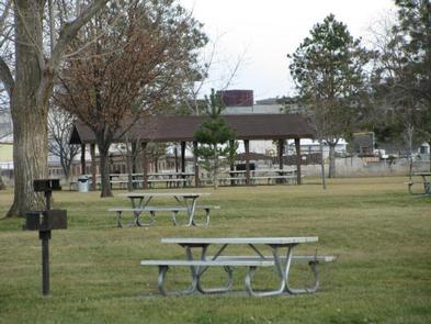
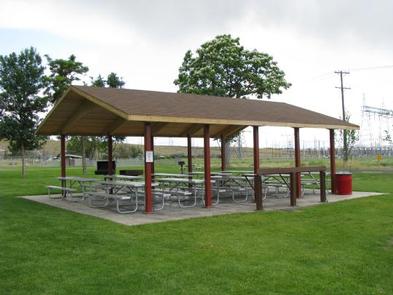
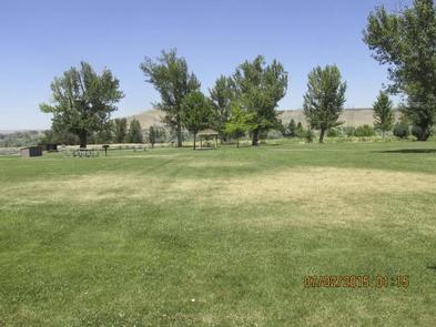
West Park offers two reservable picnic shelters. West Park #1 Steelhead Shelter has eight picnic tables and two fire grills and West Park #2 Coho Shelter has 10 picnic tables and two fire grills. Both shelters also offer electricity.

Natural Features

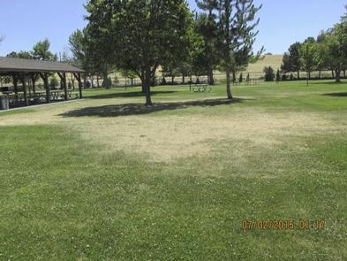
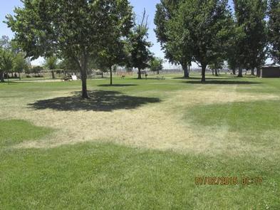
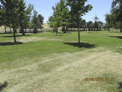
The park is located within the McNary Dam Wildlife Area. Day users enjoy the beautiful park with its mature shade trees.

Nearby Attractions

The Pacific Salmon Visitor Center, Oregon Fish Viewing Room and the McNary Dam Wildlife Area with its beautiful natural trails are all in close proximity to West Park.

Reservation

More from CampingHiking.net:

LEWIS CANYON, Arizona Campground Images, Info & Reservations

Directions Drive to Pinedale, Arizona, on State Highway 260, approximately 14 miles northwest of Show Low. Turn south on Forest Road 130 and continue approximately 2.3 miles to Junction 130A. Turn right to the group site, following the signs.  Phone 928-368-2100 Activities BIKING, CAMPING, HIKING Keywords LEWI,APACHE-SITGREAVES NF-FS Related Link(s)

HOPPER CREEK GROUP CAMP, Virginia Campground Images, Info & Reservations

Directions From I-81 North, take Exit 175 just south of Natural Bridge. Go north on U.S. Highway 11 toward Natural Bridge (left turn facing the Exxon station). From Natural Bridge, follow Route 130 East at the intersection with U.S. Highway 11 (right turn at the Natural Bridge parking lot). Continue

BLUFFVIEW PARK, Texas Campground Images, Info & Reservations

Directions From Woodville, Texas, go 11 miles east on U.S. 190. Turn south on FM 92 and go 5 miles to the park, which is on the left just north of the project office. Phone 1 (877) 444-6777 Activities CAMPING, FISHING, WILDLIFE VIEWING Keywords BFVP,TOWN BLUFF DAM,OVERLOOK PARK,DAM B,TOWN BLUFF

GRAYS MEADOWS, California Campground Images, Info & Reservations

Directions Grays Meadows is 6 miles west of the town of Independence, California. Take U.S. Highway 395 to Independence. Turn west on Market Street (which turns into Onion Valley Road) and follow for 6 miles. The first gate accesses sites 36-52. The second gate is 0.25 miles up the road