
Directions
Take Exit 4B off of I-80 and follow Route 18 north for approximately 7 miles. Before crossing over the lake, there is a stoplight at the Tara, where you will veer right onto Route 258. The entrance to the park is almost immediately on the left after you turn, just after the Tara. The picnic shelter is on the right as you are driving down the road towards the boat launch/fishing pier area.
Phone
724-646-1124
Activities
BOATING, CAMPING, FISHING, DAY USE AREA
Keywords
Related Link(s)
Pennsylvania State Road Conditions
Overview
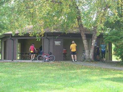
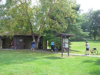
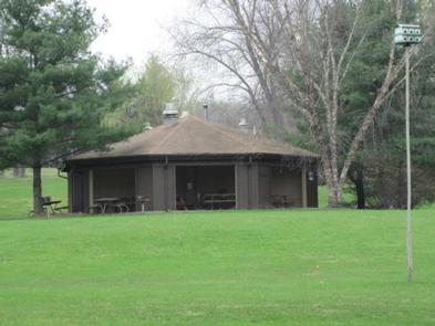
Situated within the suburban Shenango Valley, Shenango Lake provides an attractive setting where visitors can spend the day picnicking, camping, fishing, boating, or enjoying nature’s beauty at one of the lake’s many recreation areas. The Clark Recreation Day Use Area is located just off of Route 18 on Route 258 in Clark, PA, and provides one covered group picnic shelter (Clark Shelter) with electric as well as access to the lake to go fishing and boating.
Recreation
Come explore and enjoy the outdoors! The lake provides a variety of recreational opportunities, including, but not limited to, picnicking, camping, fishing, boating, swimming, hiking, viewing wildlife and hunting. Picnickers can rent, for a fee, one of our seven picnic pavilions located within four different recreation areas. Boating is a popular activity where areas are provided on the lake for unlimited horsepower operation, as well as restricted horsepower and minimum wake operation. Many fishing enthusiasts are attracted to the waters of Shenango for the crappie, bass, walleye, catfish and muskellunge that inhabit the river, lake and tailwaters. Campers visiting the lake will enjoy spacious facilities at our 330-site campground.
Facilities
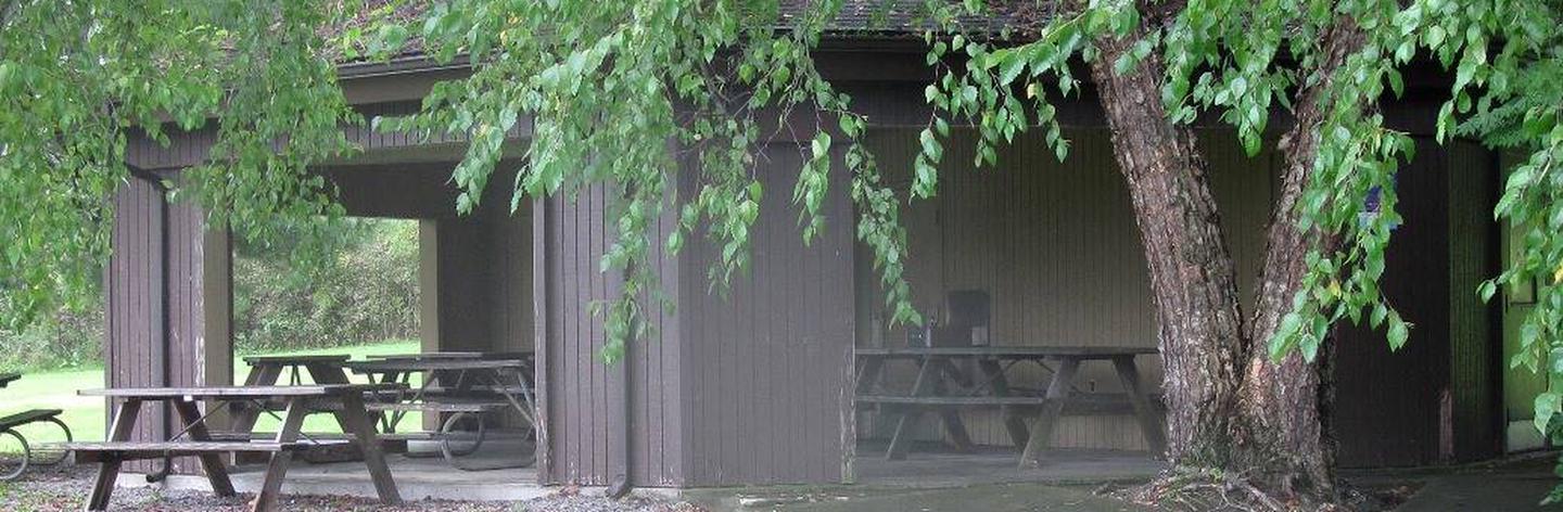
The Clark Rec Area Day Use offers one group picnic shelter (Clark Shelter) that can accommodate between 36-48 people, depending upon the use of 6-8 people per table. Electric is available at the shelter with a paid reservation only, grills are available on site, and flush toilets and drinking water are provided at the restroom attached to the shelter (seasonal). An accessible fishing pier, fish cleaning station, and paved boat ramp, as well as plenty of open fields, are located at this recreation area. Overnight camping is available just one mile north of this area at the Shenango Rec Area.
Natural Features
Shenango Lake stretches 11 miles up its namesake river, covering over 11,000 acres. The shore is lined with a northern hardwood forest of shady and colorful trees such as black cherry, beech, maple, and hemlock. Deer, turkey and other small game animals are plentiful, with excellent opportunities to observe osprey and eagles in the area.
Nearby Attractions
The Shenango Water Trail provides 7.5 miles of scenic river corridor for paddlers, with three access points between Kidds Mill Park and Big Bend. Life jackets must be worn on all canoes and kayaks. The RC’s Marina, located next to the Clark Recretion Area, offers boat rentals. The historic Kidds Mill Covered Bridge features the unique “Smith-Truss” design from the 1800s. Remnants of the Erie Extension Canal can be found nearby in Sharpsville below the Shenango Dam. The Shenango and Mahaney Recreations Areas feature restoration chestnut tree orchards that are managed through a partnership with the American Chestnut Foundation for research and education, with the goal of developing blight resistant American chestnut trees.