
Directions
Visitors can get to the island via passenger ferry (Grand Island Ferry Service) or private watercraft. The ferry departs from Grand Island Landing on the mainland, located on M-28, about 3 to 4 miles west of the Munising’s blinking light. Look for the Grand Island NRA signs. Prices and schedules vary from season to season. For information or reservations, call (906) 387-2600 or visit their website at http://www.grandislandup.com.
Phone
906-387-2512
Activities
CAMPING
Keywords
Grand Island Campsite,Grand Island NRA,GRAND ISLAND NATIONAL RECREATION AREA
Related Link(s)
Michigan State Road Conditions
Overview
Grand Island is located in Lake Superior, about one half mile from the mainland community of Munising, Michigan. Munising is about 43 miles from Marquette and 55 miles from Manistique.
Recreation
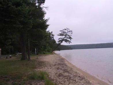
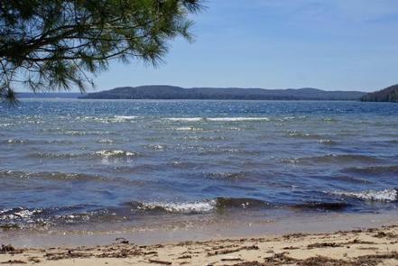
Swimming – The lake bottom is sandy, sandy with small rocks, or solid rock depending on what site you choose. Lake Superior can be cold with average high temperatures reaching only the high 60s (degrees Fahrenheit). Be cautious when swimming because this area has not been checked for possible hazards. Please remember, you swim at your own risk.
Hiking and Biking – Over 30 miles of hiking and mountain biking trails provide wonderful opportunities for day-trips and give access via unsurfaced trails to some of the Island’s most spectacular scenery.
Fishing and Hunting – Lake Superior has Coho salmon, lake trout, perch, pike, walleye and rock bass. Game species on the island include deer, bear, rabbit, grouse and ducks. A Michigan fishing, hunting and/or trapping license is required. (See the Michigan Department of Natural Resources Fishing Guide for license information and special regulations for Echo and Duck Lakes.)
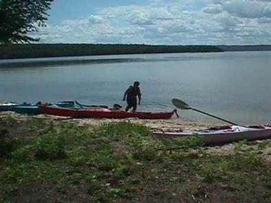
Boat Access – There are a number of sand beaches where a boat could pull right up to shore. Murray Bay, Trout Bay and North Light Creek areas have the largest sand beaches with little to no rock obstructions. There are several areas around the perimeter of the island where kayakers can gain access. Be aware that there are very few locations on the northwest and northeast sides that are not cliff. There is no boat launch or public dock facility on Grand Island. Personal watercraft (SeaDoo/Jet Ski) are not allowed on the shores of Grand Island. The dock at Williams Landing can be used for loading and unloading only. Boats may not park at the dock.
Facilities
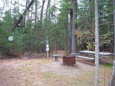
Drinking water is available at Williams Landing, Juniper Flats, Farrell Cottage and Murray Bay Day Use Area. If traveling elsewhere on the island, bring water with you or filter/boil/treat surface water. Keep soaps and detergents out of lakes and streams. Wash dishes and clothes in a pot and dispose of the waste water in a hole at least 100 feet from the nearest water supply. Bathe in a similar manner.
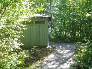
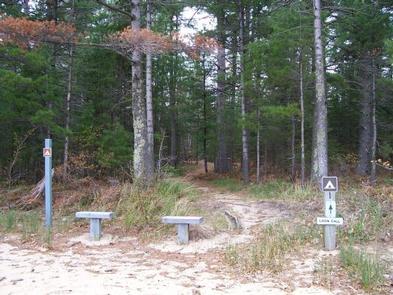
Loon Call: This campsite is located approximately 75 yards from Lake Superior and Murray Bay Beach. The site is approximately 1.5 miles from William’s Landing (ferry service arrival point, and visitor information center). The nearest potable water is at Murray Bay Day Use Area, approximately 100 yards from the campsite. This site can accommodate up to 6 people in two tents. A latrine, food storage pole and locker, fire ring, benches and firewood are provided in/near the campsite. Loon Call can be accessed via the island’s trail system and is accessible to kayakers via Murray Bay Beach.
Natural Features
Grand Island, a Congressionally designated National Recreation Area (NRA), boasts massive 300-foot wave-cut sandstone cliffs; 13,500 acres of lush forest; beaches of fine sand; winter ice caves; and historic buildings and artifacts dating back as far as 2,000 BC, to name just a few of its highlights! The island’s scenic natural beauty and interesting history make it an attractive place for camping and other outdoor activities.
Nearby Attractions
Pictured Rocks National Lakeshore, Hiawatha National Forest, and the City of Munising. The Munising Area provides a variety of restaurants, hotels, camping opportunities and outfitters. Local outfitters provide guided and self-guided kayak, canoe, pontoon and mountain bike rentals.