
Directions
Deep Bay Cabin is located on the south end of Deep Bay on the northeast corner of Zarembo Island. The cabin is a short walk from Deep Bay and about 1/4 mile from Roosevelt Harbor just off of the Zarembo Beach Road FSR 6590. The cabin is only accessible by boat or float plane, about 15 miles from Wrangell. There is a float dock, ramp, and parking area at Roosevelt Harbor. Use caution when anchoring a boat due to the rocky shoreline. Check local tide tables to determine the best time for arrival and departure.
Phone
907-874-2323
Activities
BIKING, BOATING, CAMPING, FISHING, HIKING, HUNTING, OFF HIGHWAY VEHICLE, WILDLIFE VIEWING
Keywords
Related Link(s)
Overview
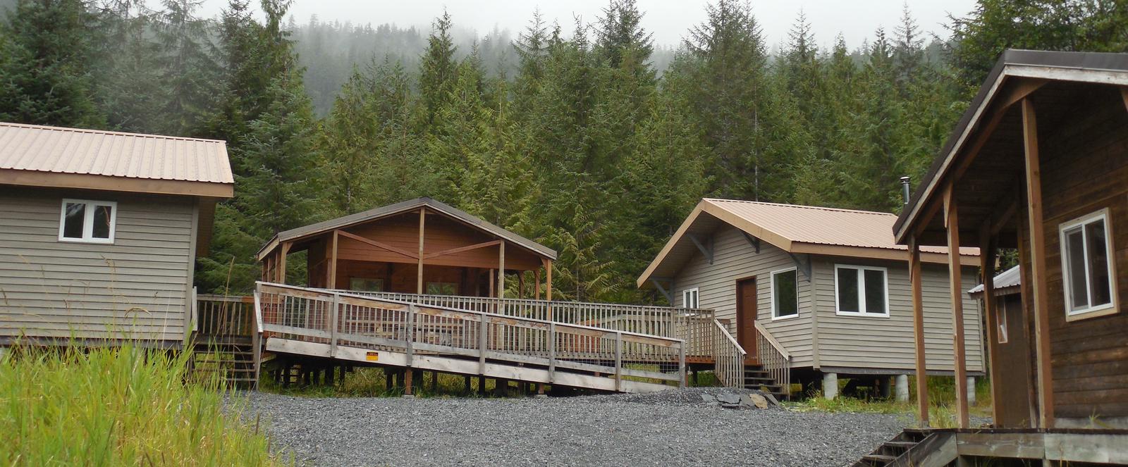
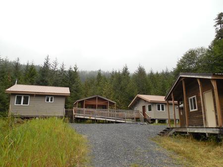
The Deep Bay Cabin is a fully ADA accessible, large group recreation cabin located on Zarembo Island. It is popular for hunting and exploring Zarembo Island’s remote road sytem. The cabin can be accessed by float plane or boat from Roosevelt Harbor, where there is a float dock, ramp and parking area, or by beach access from Deep Bay. Visitors are responsible for their own travel arrangements and safety, and must bring their own amenities.
Recreation
The cabin is located on Zarembo Island’s extensive road system which provides access and opportunities for recreation and subsistence gathering. There are excellent hunting and berry gathering opportunities. Open roads allow for use of both vehicles and ATVs. There are ATV trails on the island including the Whale Trail, where humpback whales can be observed from the shore. Zarembo’s road system is remote-all vehicles and ATVs are brought to the island by boat.
Facilities
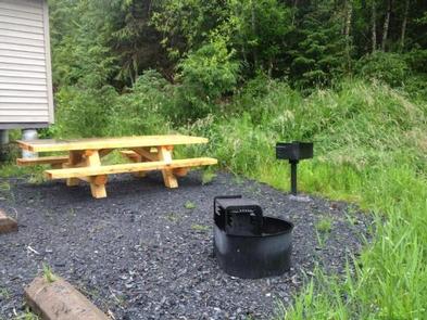
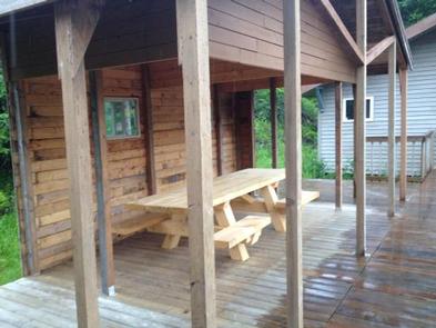
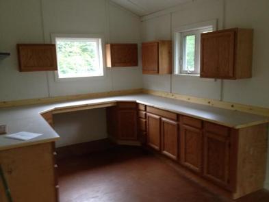
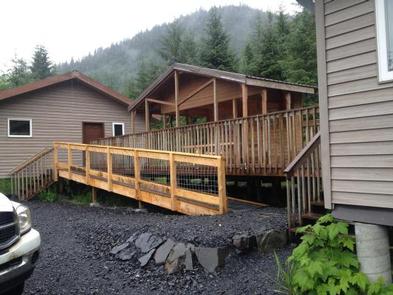
The Deep Bay Cabin is fully accessible and includes a wheelchair ramp from the parking lot to the cabin. It is a large group cabin and can accommodate up to 12 people. It consists of two buildings connected by a partially covered large deck with a picnic table. Each building has sleeping rooms and a common room. There is an oil stove for heat in each building. There is a small storage shed, an outside fire grill, picnic table, and outhouse. The wooden furnishings in the cabins were built by Wrangell High School’s industrial arts class in 2017. Water and electricity are not provided. Water is available from a small nearby stream, but guests should be sure to treat water taken from any outside source prior to consumption ( water safety tips ). It is recommended that guests bring their own water supply. Fuel oil is not provided. Guests should bring their own #1 fuel oil for the stove. Cooking facilities are also not available. Guests should bring all of their own camping amenities. Guests are expected to pack out trash and clean the cabin before leaving.
Natural Features
The cabin sits on small bench above Deep Bay in an opening in the forest. The surrounding terrain is mountainous and densely forested, with occasional muskegs. The area has abundant wildlife and marine life. Roosevelt elk are occasionally seen on the island.