MEADOW LAKE CAMPGROUND, ID Campground Reservation, Info, Images, Map, Directions

MEADOW LAKE CAMPGROUND, Idaho Campground Images, Info & Reservations

Directions

From Leadore drive 17 miles south on Highway 28 and turn right (west) on to Forest Service Road #002 at the old Gilmore Townsite. Follow the gravel road for 6 miles as it climbs 2,080 feet to the campground.

Phone

RECREATION PERSONNEL (208)756-5209 OR LEADORE OFFICE (208)768-2500

Activities

CAMPING, FISHING, HIKING, PICNICKING, DAY USE AREA, NON-MOTORIZED BOATING, WATER ACCESS

Keywords

Related Link(s)

Rec Area Info & Images

Idaho State Tourism

Idaho State Road Conditions

Overview

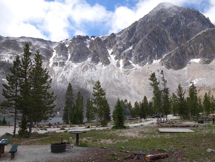
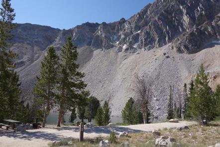
Meadow Lake Campground is located on the Leadore Ranger District of the Salmon-Challis National Forest. This high alpine campground sits at an elevation of 9,160 feet in the Lemhi Mountain Range, 22 miles from Leadore, Idaho.

Recreation

There’s no lack of recreational opportunities around Meadow Lake Campground. The lake is stocked twice a year so the fish are always biting. Fish from the bank or carry your boat down to the lake and try from the water, as there is no boat ramp or boat dock at the lake.

Hiking opportunities are available right out of the campground and include trail # 342 which provides a gentle loop around the backside of the campground. Try trail # 057 which takes you up to the steep ridge above the campground (the trail to Meadow Lake Peak is not maintained by the Forest Service).

If a slower pace is appealing, pull up a chair and soak-up the incredible views from the campground.

Facilities

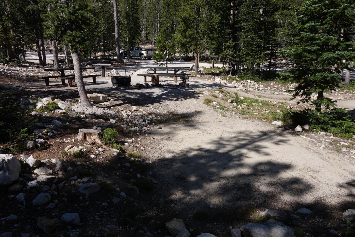
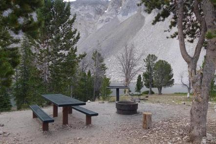
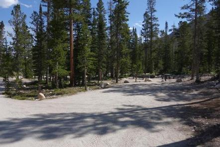
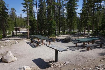
Meadow Lake Campground consists of 17 campsites and a day use area with picnic tables, fire rings and barbecue pedestals. The campground offers 2 vault toilets, drinking water and day use parking. 4 double campsites are available for larger groups with each site including 2 picnic tables, 2 tent pads, a campfire ring, a prep table, and expanded parking for 2 vehicles. The campground also offer 13 single campsites each with a picnic table, tent pad, campfire ring, prep table, and parking for 1 vehicle.

Natural Features

Meadow Lake Campground is located at the base of the 10,720-foot Meadow Lake Peak and along the banks of the 13.3-acre Meadow Lake. The high elevation campground is dotted with lodge pole pine and white bark pine trees and is frequented by deer and mountain goats.

Nearby Attractions

There are plenty of other attractions in the vicinity of Meadow Lake including the Gilmore Ghost Town and a number of other Forest Service recreation sites and trails. Stop at the Leadore Ranger Station and pick up a visitor map for more information.

Charges & Cancellations

A $8.00 non-refundable on line reservation fee may be charged for some facilities.

Reservation

More from CampingHiking.net:

WALL CREEK CABIN, Montana Campground Images, Info & Reservations

Directions From Ennis, take US Highway south for about 18 miles to Indian Creek and the McAtee Bridge fishing access site. Turn right and go nearly 1 mile to junction just beyond bridge. Turn left and travel toward Wall Creek Wildlife Management Area for 2.7 miles to T junction. Turn

EAGLE CAMPGROUND, California Campground Images, Info & Reservations

Directions From Susanville, California, take Highway 36 west for 2 miles to County Road A-1. Turn north and continue 14 miles to the Eagle Lake Recreation Area. Turn right on Gallatin Road, the first highway you will come to in the lake basin, and follow the signs to Eagle Campground.

FOUR JEFFREY, California Campground Images, Info & Reservations

Directions From Highway 395 in the center of Bishop, turn west on Line Street (Highway 168) and continue west for 14 miles, then drive south on South Lake Road. The campground is 1 mile up South Lake Road. Phone 760-873-3077 Activities BOATING, CAMPING, FISHING, HIKING, HORSEBACK RIDING Keywords FOJE,INYO NF

CHICKEN CREEK, Oklahoma Campground Images, Info & Reservations

Directions From Gore, Oklahoma, go 17.5 miles northeast on Highway 100, take the turn left and go 1.5 miles northwest on the paved access road. Follow signs into the campground. Phone 918-487-5252 Activities CAMPING, SWIMMING SITE Keywords CHOK,TENKILLER LAKE,TENKILLER FERRY LAKE,TENKILLER FERRY Related Link(s) Rec Area Info & Images Oklahoma

COPPERAS CREEK, Texas Campground Images, Info & Reservations

Directions From Comanche, Texas, take HWY 67/377 northeast for 5 miles, then turn left on FM 2861. Follow for 2.5 miles to the park entrance. Park entrance is on the North side of FM 2861. Phone 254-879-2498 Activities BOATING, CAMPING, FISHING, HIKING, HUNTING Keywords COPP,PROCTOR LAKE,LAKE PROCTOR,COPPERAS COVE,PROCTOR LAKE Related

BOOMER PARK SHELTER, North Carolina Campground Images, Info & Reservations

Directions From Charlotte, North Carolina, take I-77 North (approximately 60 miles) before merging onto Highway 421 North towards Wilkesboro/Boone. Continue to Exit 286B (approximately 20 miles), turn left onto Highway 268 and continue for approximately 6 miles. Turn left onto Boomer Road and the park will be on the right