
Directions
From the North: Follow Arizona Hwy. 85 through Ajo and Why, Arizona. The monument entrance is four miles south of Why. The Kris Eggle Visitor Center is 22 miles south of Why. The Kris Eggle Visitor Center is located on the West side of Hwy. 85 between mile marker 75 and 76. From the East (Tucson): take Arizona Hwy. 86 to Why, then turn left on Arizona Hwy. 85, heading south. From the West (Yuma): follow I-8 to Gila Bend or I-10 to Buckeye, then turn south on Arizona Hwy. 85. From the South (Sonoyta, Mexico): travel north towards Lukeville, AZ on Mexico Rt. 2. The Kris Eggle Visitor Center is five miles north of Lukeville on Hwy. 85.
Phone
520-387-6849 x 7302
Activities
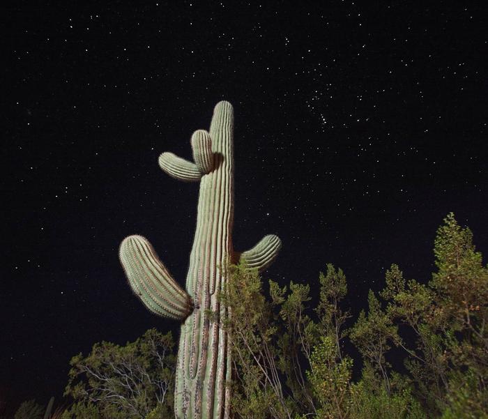
AUTO TOURING, BIKING, HISTORIC & CULTURAL SITE, CAMPING, INTERPRETIVE PROGRAMS, HIKING, PICNICKING, VISITOR CENTER, WILDLIFE VIEWING, WILDERNESS, DAY USE AREA, PHOTOGRAPHY, HORSE CAMPING, RANGER STATION, STAR GAZING, BIRDING, EVENING PROGRAMS, GUIDED INTERPRETIVE WALKS, SCENIC DRIVE, AMPHITHEATER, OFF HIGHWAY VEHICLE TRAILS
Keywords
Related Link(s)
Overview
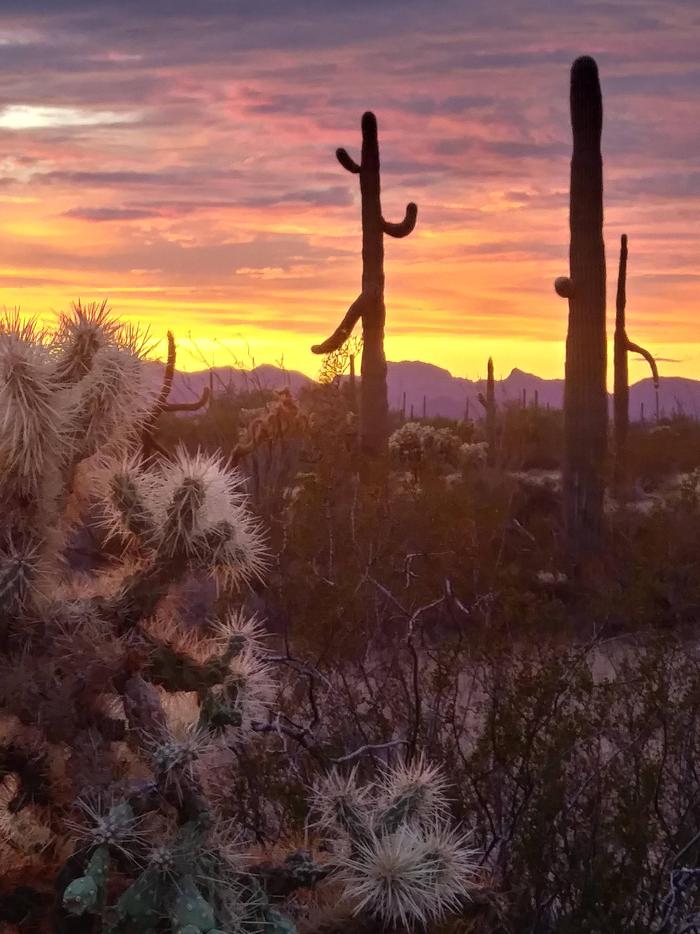
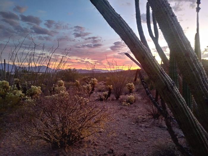
Twin Peaks Campground is located in the heart of Organ Pipe Cactus National Monument. This landscape reveals a thriving community of plants, animals, and human stories that echo throughout this desert preserve chronicling thousands of years of desert living. A scenic drive, a wilderness hike, or a night of camping will expose you to a living desert that thrives.
Recreation
Along with photography and birding, hiking is ideal here. There is a .9 mile perimeter trail around Twin Peaks Campground, and the 1.2 mile Desert View Trail located near it. Beyond the campground area there are miles and miles of trails laced around Organ Pipe Cactus National Monument some easy, others more strenuous. Some of the best hiking is off the beaten trails and out in the canyons with a map and compass to guide you. Always carry water and snacks, and avoid hiking during the hottest parts of the day. More detailed trail information is available in the park newspaper and in person at the Kris Eggle Visitor Center.
Facilities
Twin Peaks offers both group and single campsites. Single campsites must be reserved from January through March (same-day reservations are not available). From April through December campsites are available on a first-come, first-served basis. Group sites are available year-round by reservation. Reservations can be made up to 12 months in advance. Flush toilets and drinking water are located within the campground. Campsites have picnic tables and grills. Restrooms have running water and some have solar showers. No hookups available for electricity, water or sewer. A dump station is located past the last row of campsites. Generators are permitted in campsites #1-#112 from 8:00 a.m.-10:00 a.m. and 4:00 p.m.-6:00 p.m. daily. Generators are not permitted in campsites #113-#174. Campsites from #175-#208 are tent only sites.
Natural Features
Organ Pipe Cactus National Monument exhibits an extraordinary collection of plants and animals of the Sonoran Desert. This is a showcase for creatures who have adapted themselves to the extreme temperatures, intense sunlight, and little rainfall that characterize this Southwest region. Thirty-one species of cactus have mastered the art of living in this place, including the park’s namesake and the giant saguaro. Here the life of the Sonoran Desert is protected and allowed to flourish under nearly ideal wilderness conditions. The monument is an outstanding natural preserve where one of the Earth’s major ecosystems survives almost unspoiled.