Kinnikinnick (Laurance Lake) Campground, OR Campground Reservation, Info, Images, Map, Directions

Kinnikinnick (Laurance Lake) Campground, Oregon Campground Images, Info & Reservations

Listen

Directions

From I-84 in Hood River – South on highway 35 to Parkdale. Follow signs to Laurance Lake.

Phone

541-386-6366

Activities

BIKING, CAMPING, FISHING, FISH HATCHERY

Keywords

Laurance Lake Campground

Related Link(s)

Rec Area Info & Images

Oregon State Road Conditions

Oregon State Tourism

Overview

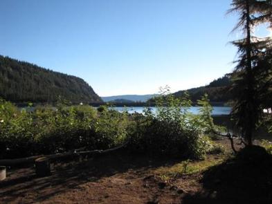
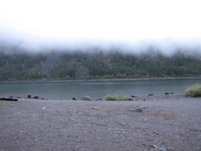
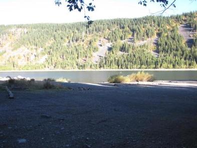
Kinnikinnick Campground is a hidden gem, situated north of Mt. Hood, just outside of Parkdale, Oregon. Sitting on Laurence Lake, Kinnikinnick Campground offers beautifully landscaped campsites with views of Laurence Lake and the wide-open hills that surround the lake.

Recreation

Laurence Lake allows all non-motorized water sports. There are no rental facilities on site.

Facilities

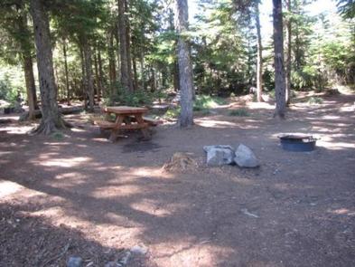
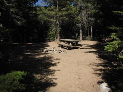
The campground features well-groomed campsites, including campfire pits and picnic tables. The location offers vault toilets. There is a boat ramp nearby.

Natural Features

Surrounded by Laurence Lake, Kinnikinnick Campground is a natural attraction all its own. With incredible lake views, regular sightings of bald eagles and rock and hill formations that surround this site, it is the perfect place to go "off the grid" and enjoy the outdoors.

Nearby Attractions

Laurance Lake is great for waterplay and fishing. Kinnickinnick Campground is just a 30-minute drive to nearby ski resorts, where summer hiking and outdoor adventures await.

Reservation

More from CampingHiking.net:

SAVENAC BUNKHOUSE, Montana Campground Images, Info & Reservations

Listen Directions From Missoula, travel west on Interstate 90 for 90 miles, to Exit 16 for Haugan. Turn right at the stop sign. At the frontage road turn right and take the first left across the cattleguard. Signs are present onsite to follow. Maps are available online or for purchase

ORLAND BUTTES, California Campground Images, Info & Reservations

Listen Directions From Interstate 5, take the Black Butte Lake exit at Orland, CA. Travel west on County Road 200/Newville Road for 6 miles. Turn left on County Road 206 and drive 4 miles to the campground. Phone 530-865-4781 Activities BOATING, CAMPING, FISHING, HIKING, HUNTING, WILDLIFE VIEWING, SWIMMING SITE Keywords

HAUSER SAND CAMPING, Oregon Campground Images, Info & Reservations

Listen Directions From North Bend Oregon, travel North on Highway 101 for 6 miles to Hauser Depot Road. Turn left on Hauser Depot Road and proceed 1/4 mile. Turn left over the railroad tracks onto Sandy Way. Proceed 1/3 mile to the Hauser sand access. To access sand camps #86-#98

BAY VIEW, Michigan Campground Images, Info & Reservations

Listen Directions 19456 W Lakeshore Drive, Brimley MI 49715 From Brimley, Michigan, travel west on County Road 42/Whitefish Bay Scenic Byway for approximately 8 miles. Bay View is on the north side of the road. Phone 906-203-9872 Activities HISTORIC & CULTURAL SITE, CAMPING, HIKING, SWIMMING SITE Keywords BYVW,Superior Lake Campground,Lake

BIG M, Missouri Campground Images, Info & Reservations

Listen Directions From Cassville, Missouri, travel east on State Route 76 for 9 miles. Turn onto the Highway M access road and follow signs into the campground. Phone 417-271-3190 Activities BIKING, BOATING, CAMPING, FISHING, HIKING, PICNICKING, VISITOR CENTER, WATER SPORTS, WILDLIFE VIEWING, SWIMMING SITE, PHOTOGRAPHY, SWIMMING, RANGER STATION, KAYAKING, WATER

SERVICE, Alabama Campground Images, Info & Reservations

Listen Directions From Coffeeville, Alabama, drive about four miles west on U.S. Highway 84 and follow the signs to campground entrance. Park is located at mile marker 20 on Highway 84. Phone 251-753-6935 Activities CAMPING Keywords SERV,COFFEEVILLE LAKE,SERVICE,COFFEEVILLE,BLACK WARRIOR Related Link(s) Rec Area Info & Images Alabama State Tourism Alabama