MARINERS POINT GROUP CAMPGROUND, CA Campground Reservation, Info, Images, Map, Directions

MARINERS POINT GROUP CAMPGROUND, California Campground Images, Info & Reservations

Directions

From I-5 take the Mountain Gate/Wonderland Blvd. Exit and go east to Bear Mountain Road. At Dry Creek Road go left to Silverthorn Road (take left Y) Follow Silverthorn Road toward the resort and take the left turn prior to entering resort. Campground is behind gate.

Phone

(530)275-8113

Activities

BOATING, CAMPING, FISHING

Keywords

Mariners Point,Mariners

Related Link(s)

Rec Area Info & Images

California State Tourism

California State Road Conditions

Overview

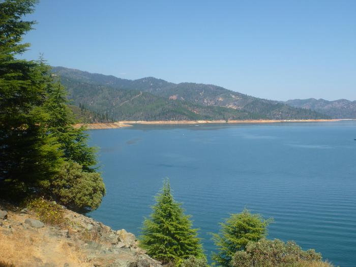
Mariners Point Campground is located where the Pit and Squaw arm of Shasta Lake come together and offers sites to both tent and RV campers. Visitors to this area can enjoy boating and fishing at the nearby Shasta Lake or hiking around the Shasta-Trinity National Forest.

Recreation

The nearest public boat ramp is six miles away in Jones Valley. Nearby lakeside resorts offer boat rentals and fuel. Shasta Lake is popular for power and non-motorized boating, fishing and water skiing. Anglers can fish for trout, catfish, Chinook salmon, crappie, bluegill, white sturgeon, brown bullhead and bass.

Facilities

All campsites have picnic tables, grills, fire rings, and parking spurs. Portable toilets are provided.

Natural Features

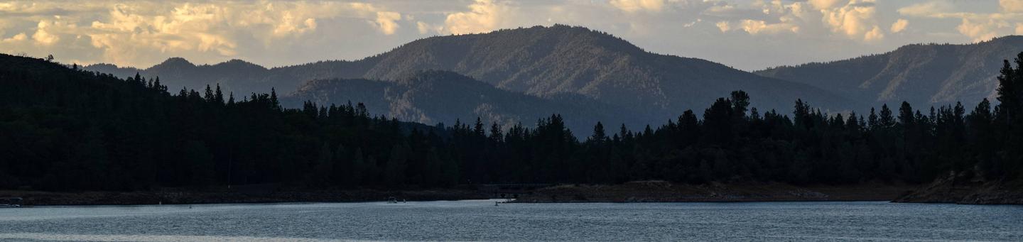
Shasta-Trinity is the largest national forest in California with a diverse landscape encompassing five wilderness areas, hundreds of mountain lakes and 6,278 miles of streams and rivers.

Lake Shasta sits at an elevation of 1,067 feet, with 365 miles of shoreline punctuated by steep mountains blanketed in manzanita and evergreens. A snow-capped Mount Shasta, the second-tallest mountain in the Cascade Range, looms in the distance.

Reservation

More from CampingHiking.net:

GEM PEAK LOOKOUT RENTAL, Montana Campground Images, Info & Reservations

Directions From Noxon: Travel the Pilgrim Creek Road 149 for approximately 13 miles to Road 2205. Follow Road 2205 for approximately 2 miles to the lookout. From Trout Creek: Travel road 2229 for 11.5 miles. Turn left after the Marten Creek Bridge and follow road 151 for approximately 11 miles

QUARRY COVE, Arkansas Campground Images, Info & Reservations

Directions From Ola, Arkansas, take Route 7 south for 9 miles. Turn west onto US-60, and continue for .5 miles and follow signs into campground. Phone 479-272-4233 Activities BOATING, CAMPING, FISHING, SWIMMING SITE Keywords QUAR,NIMROD LAKE,NIMROD LAKE Related Link(s) Rec Area Info & Images Arkansas State Road Conditions Arkansas State

TUMWATER GROUP SITE, Washington Campground Images, Info & Reservations

Directions From the west, take Highway 2 east through Monroe and over Stevens’ Pass. The Tumwater campground is approximately 20 miles east of the top of Stevens’ pass, on the left side of the highway. From the east, take Highway 2 west through Leavenworth. The campground is 10 miles west

THIRD CREEK GROUP SITE, Idaho Campground Images, Info & Reservations

Directions From Malad, travel 3.5 miles north on I-15 to exit 17. Turn east onto Weston Highway and continue for 7 miles to Upper Deep Creek Reservoir. Turn left on Forest Road 231. Go one mile to Third Creek Group Site Campground. Phone 208-236-7500 Activities BIKING, CAMPING, HIKING, HORSEBACK RIDING,

BOB SHETLER RECREATION AREA, Iowa Campground Images, Info & Reservations

Directions From I-35, take exit 90 to Ankeny/Oralabor Road and go west for 4.8 miles. The road turns into Highway 415. Turn left onto 37th Street, then turn right onto Horseshoe Road. Turn right and drive across the Saylorville Lake Dam to the campground. Phone 515-276-0873 Activities BIKING, BOATING, CAMPING,