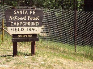
FIELD TRACT CAMPGROUND, NM Campground Reservation, Info, Images, Map, Directions

FIELD TRACT CAMPGROUND, New Mexico Campground Images, Info & Reservations

Directions

Field Tract Campground is located 10 miles north of Pecos on the right-hand side.

Phone

(505) 757-6121

Activities

CLIMBING, CAMPING, FISHING, HIKING

Keywords

Related Link(s)

Rec Area Info & Images

New Mexico State Tourism

New Mexico State Road Conditions

Overview

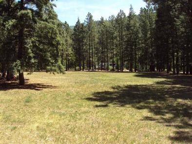
Field Tract Campground is located on the banks of the beautiful Pecos River. The campground is 10 miles north of the village of Pecos. Visitors enjoy Field Tract for its family friendly atmosphere, fishing and access to the Santa Fe National Forest.

Recreation

Field Tract Campground offers excellent fishing access on the Pecos River, picnicking and camping opportunities. It is also a short drive to nearby trailheads leading into the Pecos Wilderness.
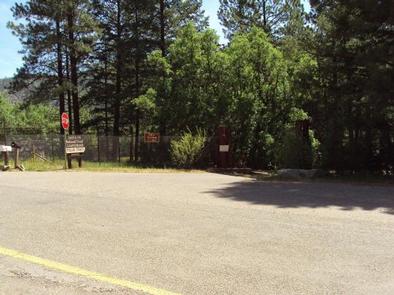
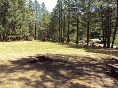
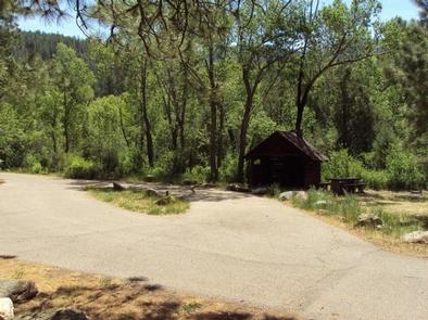
Facilities

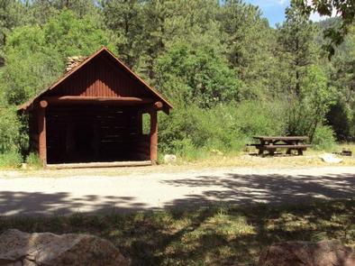
This medium sized campground offers tent and RV camping, a flush toilet and two pit toilets, drinking water, picnic tables and grills. Six of the 15 units have three-sided shelters. Campsites are suitable for trailers up to 22 feet in length.

Natural Features

Situated on the Pecos River, Field Tract Campground provides an inviting forested setting.

Nearby Attractions

Field Tract Campground offers direct access to the Pecos River and there are many terrific fishing opportunities nearby. There are also trailheads providing access to the Pecos Wilderness as well as climbing opportunities within 10 miles.

Reservation

More from CampingHiking.net:

EAST ELK CREEK GROUP CAMPSITE, Colorado Campground Images, Info & Reservations

Directions East Elk Creek Group campground is located off of US Hwy 50 between Gunnison and Montrose, on the north side of the highway approximately 1/2 miles west of Elk Creek. Phone 970-641-2337 Activities BOATING, CAMPING, FISHING, HIKING, HUNTING, WILDLIFE VIEWING Keywords EEGS,CURECANTI NATIONAL RECREATION,CURECANTI,ELK LAKE,ELK Related Link(s) Rec Area

HORSE PRAIRIE CABIN, Montana Campground Images, Info & Reservations

Directions From Dillon, travel south on Interstate 15 for about 20 miles, to Highway 324. Cross the Clark Canyon Reservoir Dam and travel west on Highway 324 for about 21 miles. At Red Butte, continue west on Forest Road 181 (Bloody Dick Road) for about 6 miles to the junction

PETTIT BAY, Oklahoma Campground Images, Info & Reservations

Directions From Tahlequah, OK, go 8.25 miles south on Highway 82, turn right on Indian Road and go two miles south. Then turn left and go one mile southeast on the paved access road. Phone 918-487-5252 Activities BOATING, CAMPING, SWIMMING SITE Keywords PETT,TENKILLER LAKE,TENKILLER FERRY LAKE,TENKILLER FERRY Related Link(s) Rec

TENDERFOOT CREEK, Alaska Campground Images, Info & Reservations

Directions From Anchorage, go south on Seward Highway approximately 81 miles to Summit Lake. Turn at milepost 46 before Summit Lake Lodge. Phone (907)288-3178 Activities BIKING, BOATING, CAMPING, FISHING, HIKING Keywords TEND,CHUGACH NF – FS Related Link(s) Rec Area Info & Images Forest Service Concessionaire Alaska State Tourism Alaska State