Directions
El Malpais is located about 80 miles west of Albuquerque and south of Grants, New Mexico. Two state highways provide access to the NCA and Monument, and both are accessible via Interstate 40. Exit 89, east of Grants, will take you along NM Highway 117 which traverses the east side. Exit 81, west of Grants, will take you along NM Highway 53 which travels down the northwestern edge. The BLM Ranger Station is located 9 miles south of I-40 Exit 89 on NM Highway 117. The GPS coordinates above correspond to the BLM Ranger Station.
El Malpais National Monument Visitor Center (National Park Service):
1900 E Santa Fe Ave. Grants, New Mexico 87020 (505) 876-2783
Phone
505-280-2918
Activities
BIKING, CAMPING, HIKING, HORSEBACK RIDING, HUNTING, PICNICKING, VISITOR CENTER, WILDLIFE VIEWING, WILDERNESS
Camping Reservations
Reserve your campsite at these camping areas:
Hiking Trails
Looking for nice hiking areas to take a hike? Choose from these scenic hiking trails:
Related Link(s)
More New Mexico Recreation Areas
BLM New Mexico YouTube Channel
El Malpais National Conservation Area
BLM New Mexico YouTube Channel
The El Malpais National Conservation Area (NCA) was established in 1987 to protect nationally significant geological, archaeological, ecological, cultural, scenic, scientific, and wilderness resources surrounding the Zuni-Bandera volcanic field. El Malpais translates to “the badlands” in Spanish.
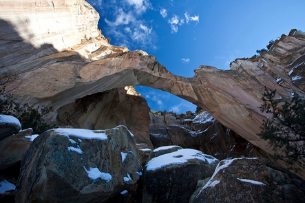
The NCA includes dramatic sandstone cliffs, canyons, La Ventana Natural Arch, Chain of Craters Back Country Byway, Joe Skeen Campground, the Narrows Picnic Area, and the Cebolla and West Malpais Wilderness Areas. There are many opportunities for photography, hiking, camping, and wildlife viewing within this unique NCA.
For more than 10,000 years people have interacted with the El Malpais landscape. Historic and prehistoric sites provide connections to the past. More than mere artifacts, these cultural resources are kept alive by the spiritual and physical presence of contemporary Native American groups, including the Ramah Navajo and Puebloan peoples of Acoma, Laguna, and Zuni. These tribes continue their ancestral uses of El Malpais including gathering plant materials, paying respect, and renewing ties.


