Directions
From Mayaguez, drive south on Route 2 (main highway) and exit Route 100 toward Cabo Rojo. When Route 100 ends, turn left onto Route 101. Drive .8 mile, then turn right onto Route 310. Drive approximately 3 mile and look for refuge sign on your left.
Phone
787-851-7258
Activities
BIKING, HIKING, VISITOR CENTER, WILDLIFE VIEWING, PHOTOGRAPHY
Camping Reservations
Reserve your campsite at these camping areas:
Hiking Trails
Looking for nice hiking areas to take a hike? Choose from these scenic hiking trails:
Related Link(s)
More Puerto Rico Recreation Areas
Cabo Rojo National Wildlife Refuge
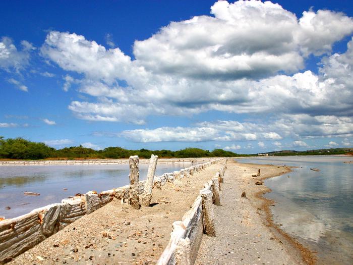
Cabo Rojo NWR, on the southwestern side of Puerto Rico, was established in 1974 when 587 of land were obtained from the Cental Intelligence Agency as an upland buffer for the Cabo Rojo Salt Flats (a potential Western Hemisphere Shorebird reserve) and its potential value as habitat for migratory birds. The 1249 acre Cabo Rojo Salt Flats, previously under private ownership were purchased and added to the refuge in1999 for a total of 1,836 acres.
The lands has been used for cattle ranching and agriculture for almost two centuries prior to Service ownership. Because of that practice much of the native vegetation has been replaced by plants from other regions and leaving the area barren except for a limited number of trees in drainages and near homesteads.
Many birds find their way to the refuge while migrating between North and South America. These birds use the refuge during the cooler months, while resident species are here year-round. It is highly valued habitat for doves and pigeons. The refuge is also a base for scientist to conduct research. The information they gather helps managers make decisions on how to protect and preserve native wildlife.


