Directions
Phone
(623) 580-5500
Activities
HIKING, HORSEBACK RIDING, WILDERNESS
Camping Reservations
Reserve your campsite at these camping areas:
Hiking Trails
Looking for nice hiking areas to take a hike? Choose from these scenic hiking trails:
Related Link(s)
Hassayampa River Canyon Wilderness
Hassayampa River Canyon Wilderness Map
Overview
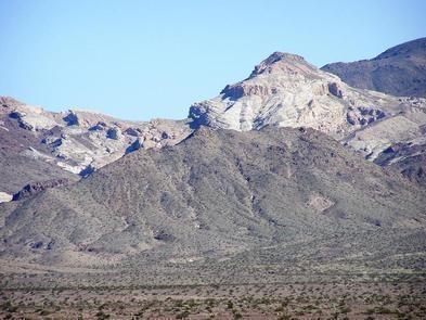
The 11,840-acre Hassayampa River Canyon Wilderness is about eight miles northeast of Wickenburg and 48 miles northwest of Phoenix, Arizona in Yavapai County. The wilderness includes several miles of free-flowing Hassayampa River and its associated riparian habitat. The side canyons and the uplands support chaparral, paloverde and saguaro plant communities. Recreation opportunities such as extended horseback riding and backpacking trips, sightseeing and photography are enhanced by the diverse topography, scenic character, and size, as well as the botanical, wildlife, and cultural values of the area.
Know Before You Go
- In wilderness, you can enjoy challenging recreational activities and extraordinary opportunities for solitude. Please follow the regulations in place for this area, and use Leave No Trace techniques when visiting to ensure protection of its unique natural and experiential qualities.
- Motorized equipment and equipment used for mechanical transport are generally prohibited on all federal lands designated as wilderness. This includes the use of motor vehicles (including OHVs), motorboats, bicycles, hang gliders, wagons, carts, portage wheels, and the landing of aircraft including helicopters Contact the agency for more information about regulations.
- Some lands around and within the wilderness are not federally administered. Please respect the property rights of the owners and do not cross or use these lands without their permission.


