Directions
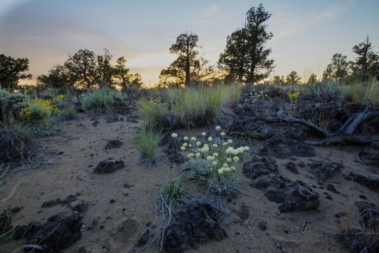
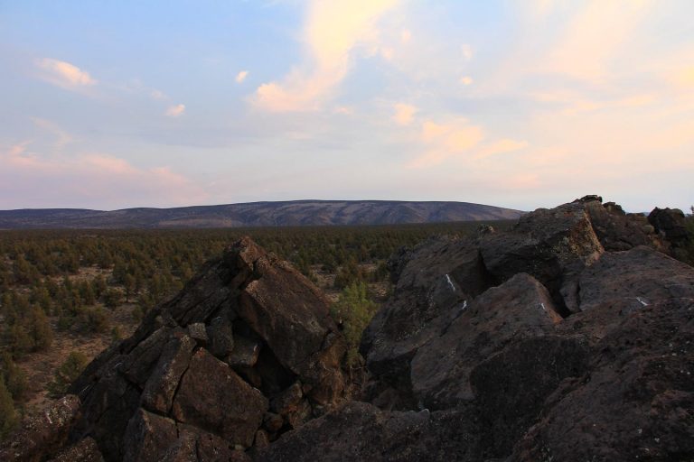
At 29,180 acres, the Oregon Badlands Wilderness is a vast expanse of lava outcrops and weathered western junipers. Five trailheads offer access to fifty miles of trails crossing the wilderness that are open to hiking and horseback riding. The Oregon Badlands Wilderness is open year-round, but is mostly accessed in the Fall, Winter and Spring.
From Highway 20 and 3rd street in Bend, Oregon, drive east 17.9 miles to the Oregon Badlands Wilderness sign, turn left on the paved road and proceed 1 mile to the Badlands Rock trailhead.
It is located about 1500 feet northeast of milepost 15 on Highway 20. Highway 20 traverses the shield along a straight, five-mile stretch between the intersections with an old section of Highway 20 (between mileposts 12.6 and 17.5).
Phone
541-416-6700
Activities
CLIMBING, HISTORIC & CULTURAL SITE, HIKING, HORSEBACK RIDING, WILDERNESS, DAY USE AREA, INFORMATION SITE, PHOTOGRAPHY
Camping Reservations
Reserve your campsite at these camping areas:
Hiking Trails
Looking for nice hiking areas to take a hike? Choose from these scenic hiking trails:
Related Link(s)
Nearby Recreation: Reynolds Pond Recreation Site
The United States Congress designated the Oregon Badlands Wilderness in 2009 and it now has 29,180 acres. All of this wilderness is located in Oregon and is managed by the Bureau of Land Management (BLM).
The Oregon Badlands Wilderness holds a number of remarkable and exciting landforms and geologic features. Most of the area includes the rugged Badlands volcano, which has features of inflated lava. Windblown volcanic ash and eroded lava make up the sandy, light-colored soil that covers the low and flat places in these fields of lava. Dry River, active during each of several ice ages, marks the southeast boundary between two volcanic areas”Badlands volcano and the Horse Ridge volcanoes. Earth movements along the Brothers Fault Zone have faulted and sliced up the old Horse Ridge volcanoes, but not Badlands volcano. The Badlands formed in an unusual way. The flow that supplied lava to the Badlands apparently developed a hole in the roof of its main lava tube. This hole became the source of lava that built a shield volcano that we call the Badlands (technically, a rootless shield volcano). An irregularly-shaped pit crater at the top of the shield marks the site where lava flowed in all directions to create the Badlands.
A variety of wildlife species inhabit the area including yellow-bellied marmots, bobcat, mule deer, elk, and antelope. The southern portion of the Badlands Wilderness includes crucial winter range for mule deer. Avian species include prairie falcons and golden eagles.
You can also explore cracked volcanic pressure ridges, called tumuli, or walk narrow moat-like cracks in the ground. Traces of human history are visible to the careful observer. At 29,000 acres, the Oregon Badlands Wilderness represents an outstanding example of ancient western juniper woodlands atop Columbia River Basalts. Almost 50 miles of trails offer the visitor many opportunities for hiking or horseback riding loops of various lengths.
As a designated wilderness, the Oregon Badlands Wilderness enjoys the highest level of permanent protection!
Leave No Trace principles:
- Plan Ahead and Prepare
- Travel and Camp on Durable Surfaces
- Dispose of Waste Properly
- Leave What You Find
- Minimize Campfire Impacts
- Respect Wildlife
- Be Considerate of Other Visitors
Regulations:
Motorized equipment and equipment used for mechanical transport are generally prohibited on all federal lands designated as wilderness. This includes the use of motor vehicles (including OHVs), motorboats, motorized equipment, bicycles, hang gliders, wagons, carts, portage wheels, and the landing of aircraft including helicopters, unless provided for in specific legislation. In a few areas some exceptions allowing the use of motorized equipment or mechanical transport are described in the special regulations in effect for a specific area. Contact the agency for more information about regulations

