Directions
The refuge office is located about a mile north of the town of Kihei. Look for the familiar U.S. Fish and Wildlife Service logo (with the dark blue fish and goose) at the entrance, located at milepost 6 of Mokulele Highway (Highway 311). The office is less than 0.5 miles down this road. Parking is limited; groups of more than 20 people please phone ahead.
Phone
808-875-1582
Activities
INTERPRETIVE PROGRAMS, WILDLIFE VIEWING
Camping Reservations
Reserve your campsite at these camping areas:
Hiking Trails
Looking for nice hiking areas to take a hike? Choose from these scenic hiking trails:
Related Link(s)
Kealia Pond National Wildlife Refuge
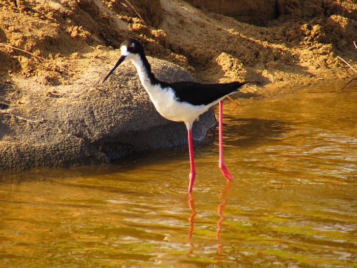
Kealia Pond National Wildlife Refuge is one of the few natural wetlands remaining in the Hawaiian Islands. Located along the south central coast of the island of Maui between the towns of Kihei and Ma’alaea, this 691-acre wetland is home to the endangered Hawaiian coot (ae’o) and Hawaiian coot (‘alae ke oke’o). The refuge is adjacent to Kealia Beach, which is a nesting ground for the endangered hawksbill turtle. Kealia Pond serves as a settling basin a 56-square mile watershed that results in seasonal intermittent flooding during winter months and dryer conditions during late summer months. This creates open water (200 acres) and shallow mud flat areas interspersed with vegetation, which provide suitable resting, feeding, and nesting habitat for endangered water birds. During certain times of the year, the refuge supports at least half of the Hawaiian stilt population. The pond also supports a diverse assemblage of migratory birds from late summer (August) to early spring (April). It is one of the most important areas in the state for wintering migratory waterfowl. Migratory shorebirds also congregate here to take advantage of the food resources along the water’s edge. As water recedes, fish are crowded into the remaining water, making them easy prey for ‘auku’u (black-crowned night herons). Approximately 2,700 people visit the refuge each year to engage in various wildlife-oriented activities, including bird watching, photography, environmental education, habitat restoration projects that involve removal of exotic species, and outplanting with Hawaii’s native vegetation.

