Lone Tree Trail, Wyoming Camping & Hiking

Lone Tree Trail, Wyoming Camping & Hiking

Lone Tree Trail Image Gallery

Directions

From Medicine Lodge State Park, travel the Cold Springs Road for approximately 7 miles and turn onto the signed two-track.

Phone

307-347-5100

Activities

HIKING, WILDLIFE VIEWING, PHOTOGRAPHY

Camping Reservations

Reserve your campsite at these camping areas:

Wyoming Campgrounds

Hiking Trails

Looking for nice hiking areas to take a hike? Choose from these scenic hiking trails:

Wyoming Hiking Trails

Related Link(s)

More Wyoming Recreation Areas

BLM Wyoming YouTube

BLM Wyoming Twitter

BLM Wyoming Flickr

BLM Wyoming Facebook Page

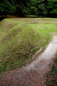
This challenging 3/4-mile trail leads to the magnificent Paint Rock Canyon and is a steep and rocky journey to Paint Rock Creek where it meets the Paint Rock Canyon Trail. The route to the Lone Tree Trail is marked by a sign on the Cold Springs Road, about 6 miles beyond the Paint Rock Canyon trailhead.

Horses or mountain bikes are not recommended on the Lone Tree Trail.

More from CampingHiking.net:

Turkey Creek, Arizona Camping & Hiking

Directions To reach Turkey Creek, drive 15 miles northwest of Safford on Highway 70. Turn west on Aravaipa-Klondyke Road and go approximately 45 miles, passing through the town of Klondyke

Temblor, California Camping & Hiking

Directions Although there are numerous informal routes into Temblor SRMA across private oil fields, legal public access to Temblor SRMA is currently limited. Negotiations to provide legal public access are