Directions
From Susanville travel North on Hwy 395 for app. 25 miles. Turn East (right) on Smoke Creek Road. The trail parallels Smoke Creek Road.
Phone
530-257-0456
Activities
AUTO TOURING, BIKING, CAMPING, HIKING, HORSEBACK RIDING, HUNTING, WILDLIFE VIEWING, PHOTOGRAPHY
Camping Reservations
Reserve your campsite at these camping areas:
Hiking Trails
Looking for nice hiking areas to take a hike? Choose from these scenic hiking trails:
Related Link(s)
More California Recreation Areas
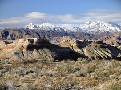
The Nobles Trail is a branch of the California National Historic Trail, located outside of Susanville, Ca. The California National Historic Trail was a mid-19th century highway for human movement to lures of gold and farmland in California. Between 1841 and 1869, more than 200,000 emigrants traversed the California Trail. The movement of thousands of people and animals along this trail caused many changes to the lifeways of Native Americans.The trail winds 2,000 miles from Missouri, through Kansas, Nebraska, Colorado, Wyoming, Idaho, Utah, Nevada, Oregon, to central California.
Visitors can access the portion of Nobles trail from the Smoke Creek Road off of Highway 395 North just outside of Susanville, Ca. For directions and more information contact the BLM office in Susanville at 530-257-0456.


