Directions
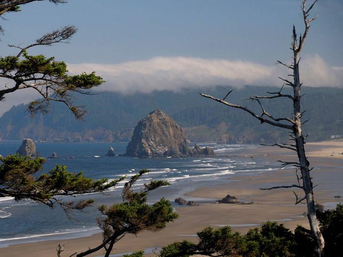
Coquille Point, a mainland unit of Oregon Islands Refuge, is located just west of downtown Bandon. This area provides a fully accessible and panel-interpreted quarter-mile trail with fabulous coastal views. To get to Coquille Point turn west off of Highway 101 onto 11th Street and drive to the ocean.
Phone
541-867-4550
Activities
HIKING, WILDLIFE VIEWING
Camping Reservations
Reserve your campsite at these camping areas:
Hiking Trails
Looking for nice hiking areas to take a hike? Choose from these scenic hiking trails:
Related Link(s)
Oregon Islands Refuge includes over 1,400 coastal islands, rocks, and reefs scattered along the 320 miles of the Oregon coast, from Tillamook Head south to the California border. Most of this refuge is included in Oregon Islands Wilderness Area. The majority of Oregon’s estimated 1.2 million seabirds, including 13 different species, annually breed on this refuge. Refuge sites are also used by brown pelicans (endangered species), bald eagles (threatened species), and the recently delisted peregrine falcons and Aleutian Canada geese. The rocks, reefs, and islands are also important breeding, pupping, molting, and haul out sites for thousands of seals and sea lions to rest. The Rogue and Orford Reef units of this refuge constitute the largest pupping area for the Federally listed threatened Stellar’s sea lions in U.S. waters south of Alaska, with 700-800 pups produced annually. Simpson Reef at Cape Arago is the world’s northernmost pupping site for northern elephant seals, and is the largest marine mammal haul out site on the Oregon coast. Although many of the offshore islands can be viewed from land, the only portion of Oregon Islands refuge that is open to the public is Coquille Point, located just west of Bandon. This picturesque headland provides a fantastic vantage point for observing seabirds and marine mammals. Other major seabird nesting islands and marine mammal use areas can be viewed from the refuge’s viewing decks located on Oregon State Park lands, including Cape Arago and Cape Meares.

