Directions
Oxford Slough Waterfowl Production area is just east of the village of Oxford. Turn off Route 91 about 2 miles north of the village of Swan Lake onto Road D1, continue south until the village of Oxford. Go into Oxford and take the small bypass road on the east side of town. Turn east just north of town, onto a gravel road that skirts the north edge of the waterfowl production area. About three-quarters of a mile east of this intersection, the access road turns toward the marsh. There is a small parking lot. This road may not be obvious or may be overgrown with vegetation. It is not advisable to try this road during wet weather or when the frost is leaving the ground in spring.
Phone
208-847-1757
Activities
BOATING, HUNTING
Camping Reservations
Reserve your campsite at these camping areas:
Hiking Trails
Looking for nice hiking areas to take a hike? Choose from these scenic hiking trails:
Related Link(s)
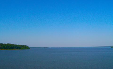
Oxford Slough Waterfowl Production Area is in Franklin and Bannock counties on the edge of Oxford in southeast Idaho. It was purchased to protect redhead nesting habitat. The area is largely hardstem bulrush marsh, interspersed with open water and surrounded by areas of playa, saltgrass flats, native wet meadow, and some cropland. The lower areas have visible alkali deposits. The marsh is fed on the north and drained at the south by Deep Creek. A smaller creek and several springs feed the marsh from the west. Attempts to drain it in the 1950s were marginally successful; the drainage ditches still exist but have mostly filled in. The native pasture is no longer grazed. Most of the meadows are hayed to provide short grass feeding areas for geese and cranes. Most of the dry cropland has been converted to dense nesting cover. The irrigated cropland is used for small grains under a cooperative farm agreement; a portion of the crop is left each year for wildlife.

