Directions
From Reno, take Interstate 80 east to Wadsworth. Travel north for 75 miles on State Highway 447 to Gerlach.
Phone
775-623-1500
Activities
AUTO TOURING, CLIMBING, HISTORIC & CULTURAL SITE, CAMPING, INTERPRETIVE PROGRAMS, HORSEBACK RIDING, HUNTING, OFF HIGHWAY VEHICLE, WATER SPORTS, WILDLIFE VIEWING
Camping Reservations
Reserve your campsite at these camping areas:
Hiking Trails
Looking for nice hiking areas to take a hike? Choose from these scenic hiking trails:
Related Link(s)
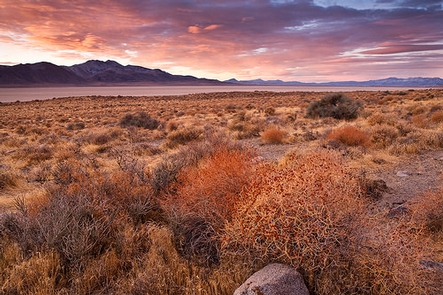
Spectacular scenic opportunities abound in one of the largest and flattest alkaline playas in the United States. The Playa is a now-dry remnant of ancient Lake Lahontan; it is 44 miles long (oriented north-south), and averages 7 miles in width. Opportunities for solitude are considerable. A variety of interesting geologic features dominate the landscape. The near-pristine Applegate-Lassen section of the California National Historic Trail traverses the Playa.
For more information, go to https://www.blm.gov/black-rock-desert-high-rock-canyon-emigrant-trails-nca.


