Craters Of The Moon National Monument & Preserve, Idaho Camping & Hiking

Craters Of The Moon National Monument & Preserve, Idaho Camping & Hiking

Craters Of The Moon National Monument & Preserve Image Gallery

Directions

Visitor Center and Loop Drive are located 18 miles southwest of Arco, Idaho on U.S. Highway 20/26/93, 24 miles northeast of Carey, Idaho on U.S. Highway 20/26/93, 84 miles from Idaho Falls, and 90 miles from Twin Falls. Physical address is 1266 Craters Loop Road(Lat/Long: 43° 27.711’N/113° 33.7) Access to the main visitor use area is via a paved highway. Unpaved roads provide additional access to the BLM monument and NPS Preserve but should only be utilized by four wheel drive and high clearance vehicles.

Phone

(208) 527-1300

Activities

AUTO TOURING, BIKING, CAMPING, HIKING

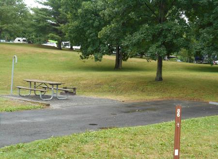
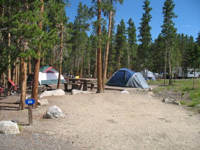
Camping Reservations

Reserve your campsite at these camping areas:

Idaho Campgrounds

Craters of the Moon Group Campground

Hiking Trails

Looking for nice hiking areas to take a hike? Choose from these scenic hiking trails:

Idaho Hiking Trails

Related Link(s)

More Idaho Recreation Areas

Craters Of The Moon National Monument & Preserve Official Website

Craters Of The Moon National Monument & Preserve Map

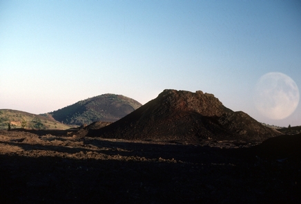
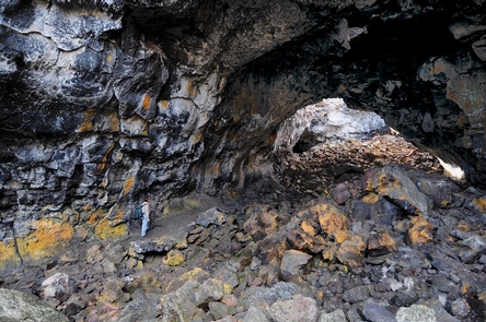
Craters of the Moon is a vast ocean of lava flows with scattered islands of cinder cones and sagebrush. We invite you to explore this “weird and scenic landscape” where yesterday’s volcanic events are likely to continue tomorrow…

More from CampingHiking.net:

National Elk Refuge, Wyoming Camping & Hiking

Directions The National Elk Refuge is located just northeast of the town of Jackson, Wyoming, and directly south of Grand Teton and Yellowstone National Parks. U.S. Highways 26/191 pass directly

Brea Dam, California Camping & Hiking

Directions At the intersection of Harbor Blvd. and Bastanchury, 5 miles north of I-5 on Harbor Blvd. Phone (213) 452-3402 Activities BIKING, HIKING, HORSEBACK RIDING, PICNICKING, PLAYGROUND PARK SPECIALIZED SPORT

Burnt Hollow, Wyoming Camping & Hiking

Directions From I-90, take Exit 124 and turn north on WY 50/Skyline Drive and continue 0.3 mile to the intersection with Hwy 14/16/59. Turn left onto Highway 14/16/59 and travel

Lewiston National, California Camping & Hiking

Directions About 40 miles west of Redding, California on State Highway 299. Access road, Trinity Dam Blvd. Phone 916-623-2121 Activities AUTO TOURING, BIKING, BOATING, CAMPING, INTERPRETIVE PROGRAMS, FISHING, HIKING, HUNTING,