


Directions
The park entrance is located 33 miles northeast of Moorcroft, 27 miles northwest of Sundance, and 52 miles southwest of Belle Fourche, SD. If approaching from the east or west, take US Hwy 14 to WY 24 (follow the signs from I-90). If approaching from the north, take WY 112 to WY 24 (from Montana) or SD 34 / WY 24 (from South Dakota).
Phone
(307) 467-5283
Activities
CLIMBING, CAMPING, HIKING, WILDLIFE VIEWING
Camping Reservations
Reserve your campsite at these camping areas:
Hiking Trails
Looking for nice hiking areas to take a hike? Choose from these scenic hiking trails:
Related Link(s)
Devils Tower National Monument Official Website
Devils Tower National Monument Map
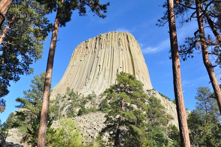
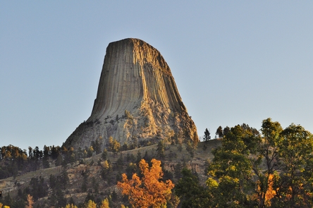
The Tower is an astounding geologic feature that protrudes out of the prairie surrounding the Black Hills. It is considered sacred by Northern Plains Indians and indigenous people. Hundreds of parallel cracks make it one of the finest crack climbing areas in North America. Devils Tower entices us to learn more, explore more and define our place in the natural and cultural world.