Directions
South on I 95 to U.S. 17: Exit 38 and Left onto Spur 25. Follow Spur 25 until U.S. 17. Take a right on U.S. 17 (south). North on I 95 to U.S. 17: Exit 29 and Right onto U.S. 17. From US 17: Take Causeway to St. Simons Island. Take first left onto Sea Island Rd. Go 1.5 miles to third traffic light, and Left onto Frederica Road. Follow Frederica Road for two miles (take second right off roundabout). The park entrance 300 yards past Christ Church.
Phone
(912) 638-3630
Camping Reservations
Reserve your campsite at these camping areas:
Hiking Trails
Looking for nice hiking areas to take a hike? Choose from these scenic hiking trails:
Related Link(s)
Fort Frederica National Monument Official Website
Fort Frederica National Monument Map
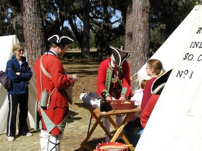
Georgia’s fate was decided in 1742 when Spanish and British forces clashed on St. Simons Island. Fort Frederica’s troops defeated the Spanish, ensuring Georgia’s future as a British colony. Today, the archeological remnants of Frederica are protected by the National Park Service.


