Directions
The sanctuary is an 842-square-mile (638-square-nautical-mile) marine protected area at the mouth of Massachusetts Bay. The sanctuary boundary is somewhat rectangular, stretching from three miles southeast of Cape Ann to three miles north of Cape Cod. The sanctuary is about 25 miles east of Boston, and lies totally within federal waters. It encompasses all of Stellwagen and Tillies Banks, and the southern portion of Jeffreys Ledge.
Phone
781-545-8026
Activities
BOATING, INTERPRETIVE PROGRAMS, FISHING, WATER SPORTS, WILDLIFE VIEWING, PHOTOGRAPHY, DIVING
Camping Reservations
Reserve your campsite at these camping areas:
Hiking Trails
Looking for nice hiking areas to take a hike? Choose from these scenic hiking trails:
Related Link(s)
More Massachusetts Recreation Areas
Stellwagen Bank National Marine Sanctuary Map
Stellwagen Bank National Marine Sanctuary Facebook page
Stellwagen Bank National Marine Sanctuary
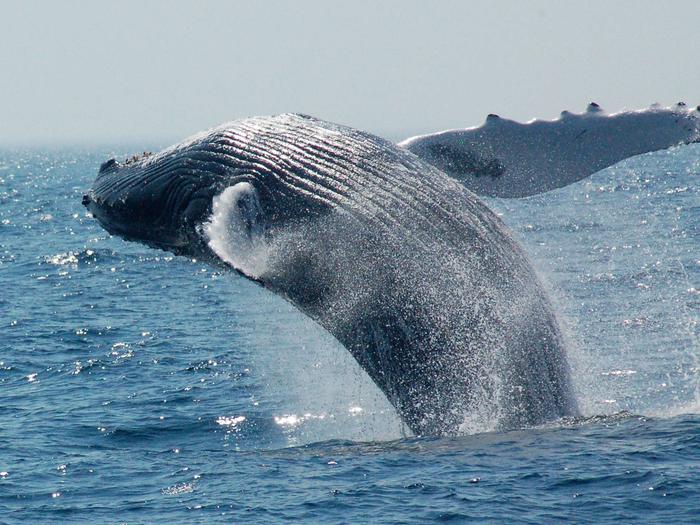
The slow retreat of massive Ice Age glaciers formed what is today the seafloor of Gerry E. Studds Stellwagen Bank National Marine Sanctuary. At the mouth of Massachusetts Bay and centrally located in the sanctuary is the sand and gravel plateau that gives the sanctuary its name. The nutrient-rich waters above and around the bank support a dynamic and diverse ecosystem that has been famous as a fishing ground for more than 400 years and claims status as the birthplace of East Coast whale watching and one of the world’s premiere sites to view great whales. Historic New England shipping routes cross the sanctuary, and over the course of centuries, the seafloor here has become a repository for shipwrecks — time capsules of our maritime heritage. The entire sanctuary encompasses 842-square miles of open ocean some 25 miles east of Boston. This wild ocean place near an urban world was designated as a sanctuary in 1992. Whale watching, bird watching, diving, and fishing can be enjoyed by visitors to Stellwagen Bank National Marine Sanctuary.


