Carbon Canyon Dam, California Camping & Hiking

Carbon Canyon Dam, California Camping & Hiking

Carbon Canyon Dam Image Gallery

Directions

Located on Carbon Canyon Road (SR42), about 5 miles east of the I-57 Freeway.

Phone

(213) 452-3402

Activities

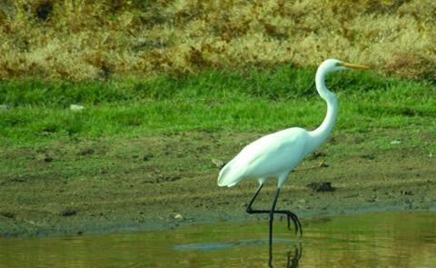
FISHING, HIKING, PICNICKING, WILDLIFE VIEWING, PLAYGROUND PARK SPECIALIZED SPORT SITE

Camping Reservations

Reserve your campsite at these camping areas:

California Campgrounds

Hiking Trails

Looking for nice hiking areas to take a hike? Choose from these scenic hiking trails:

California Hiking Trails

Related Link(s)

More California Recreation Areas

Carbon Canyon Dam Website

Managed by Orange County, there is no permanent pool, but varied facilities such as fishing, picnic areas, a nature trail, and tennis. The site of the historic oil boom town of Olinda. Adjoins Chino Hills State Park.

More from CampingHiking.net:

La Cueva, New Mexico Camping & Hiking

Directions Visitors should park and check in at the Dripping Springs Visitor Center, located 10 miles east of Las Cruces, on the west side of the Organ Mountains. From Exit

Mohawk Dam, Ohio Camping & Hiking

Directions Mohawk Dam is approximately 15 miles west of Coshocton, Ohio and 25 miles east of Mount Vernon, Ohio. Access to the dam is via State Route 36 (which connects

Carter Reservoir (Carter Lake), Colorado Camping & Hiking

Directions Access by county road north from Berthoud, Colorado. Very near Loveland. Phone 970-679-4570 Activities BIKING, BOATING, CAMPING, INTERPRETIVE PROGRAMS, FISHING, HIKING, PICNICKING, RECREATIONAL VEHICLES, VISITOR CENTER, WATER SPORTS, WILDLIFE