Directions
Getting to the Byway:
Getting to the Byway
Safford serves as the main access point for the Black Hills Back Country Byway.
From Safford:
- Take US 70 southwest out of Safford
- Merge onto US 191 northeast which is also the Old Safford-Clifton Road
- Follow US 191 until you come to milepost 139
- Turn left onto the Black Hills Backcountry Byway
From Tucson to Safford
- Go west on E. Broadway Blvd. Toward N. Country Club Rd.
- Make a U-turn onto E. Broadway Blvd.
- Turn right onto S. Salvernon Way
- Merge onto I 10 E. by the ramp on the left going toward El Paso
- Take the US 191 North exit (exit 352) toward Safford
- Turn left onto US 191 North
- Follow US 191 for 33.7 miles and turn right onto US 191/US 70/The Old West Highway
- In Safford take US 70 southwest out of town
- Merge onto US 191 northeast, which is also the Old Safford-Clifton Road
- Follow US 191 until you come to milepost 139
- Turn left onto the Black Hills Back Country Byway
From Phoenix to Safford
- Go west on E. Washington St. toward N. Central Ave.
- Turn left onto S. 1st Ave.
- Turn left onto W. Lincoln St.
- Turn right onto South 7th St.
- Turn left onto E. Maricopa Freeway
- Merge onto I 17 South/US 60 East via the ramp on the left going toward Tucson
- Merge onto I 10 East/US 60 East via the exit on the left going toward Globe/Tucson
- Merge onto US 60 East through exit 154 toward Mesa-Globe
- Stay on US 60 for 80.4 miles until it becomes US 70
- Stay on US 70 for 76.3 miles until you reach Safford
- In Safford take US 70 southwest out of town
- Merge onto US 191 northeast which is also the Old Safford-Clifton Road
- Follow US 191 until you come to milepost 139
- Turn left onto the Black Hills Backcountry Byway
Navigating the Byway:
Driving the Byway
Follow US 191 northwest until you come to milepost 139. Turn left onto the Black Hills Back Country Byway. Follow this road for 21 miles. There will be mileposts along your way to tell you how far you have gone. The road will rejoin US 191 three miles south of Clifton at milepost 160, where the byway ends.
Phone
928-348-4400
Activities
AUTO TOURING, BIKING, HISTORIC & CULTURAL SITE, INTERPRETIVE PROGRAMS, FISHING, HIKING, HUNTING, PICNICKING, WILDLIFE VIEWING
Camping Reservations
Reserve your campsite at these camping areas:
Hiking Trails
Looking for nice hiking areas to take a hike? Choose from these scenic hiking trails:
Related Link(s)
The Black Hills Back Country Byway is the perfect place to go for a thrilling drive in your off-road vehicles. The byway also offers a challenge for experienced mountain bikers or hikers. Other hobbies you could try your hand at are horseback riding, birding, photographing wildlife, fishing and hunting, or even rock collecting. Rockhound is open for digging unique stones. One of the most popular stones to collect is Fire Agate.
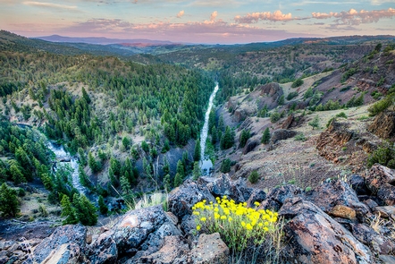
The Black Hills area includes parts of the Gila River. Take a picnic to the old Safford Bridge, or join the rafters floating down the river. About a quarter of a mile hike up an old abandoned road along the river leads to the hottest natural hot springs in Arizona. The waters are only accessible during low river flow but they stay a constant 180 degrees Fahrenheit.

