OLALLIE ON MCKENZIE HIGHWAY, OR Campground Reservation, Info, Images, Map, Directions

OLALLIE ON MCKENZIE HIGHWAY, Oregon Campground Images, Info & Reservations

Listen

Directions

From Eugene, take I-105 east to McKenzie Highway 126 for 55 miles to McKenzie Highway. Travel 13 miles beyond McKenzie Highway on 126 East. Olallie is on the left-hand side of the road.

Phone

801-226-3564

Activities

FISHING, HIKING

Keywords

OLAL,WILLAMETTE NF -FS

Related Link(s)

Rec Area Info & Images

Forest Service Concessionaire

Oregon State Tourism

Oregon State Road Conditions

Overview

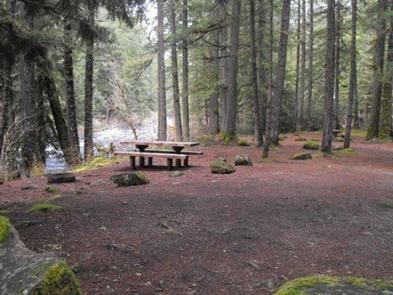
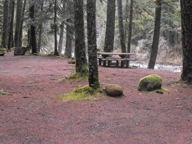
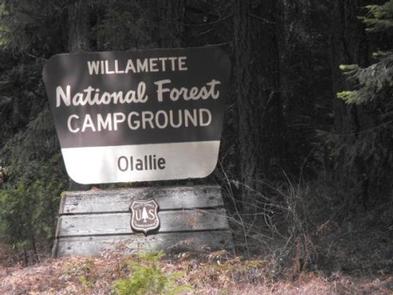
Nestled on the banks of the McKenzie River and Olallie Creek, Olallie Campground provides a superb setting for a getaway into nature. The lower loop offers mesmerizing views of both the river and the creek while the upper loop is set further in the trees with many sites facing the creek. The McKenzie River is a tributary of the Willamette River that runs for 90 miles, flowing into the southernmost end of the Willamette Valley.

Recreation

Fishing, rafting and swimming are three top activities in the river. A day use picnic area is also available at the campground. Nearby is the 26 mile McKenzie River National Recreation Trail, which provides access to world class mountain biking and hiking.

Facilities

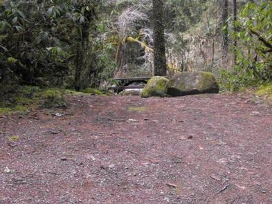
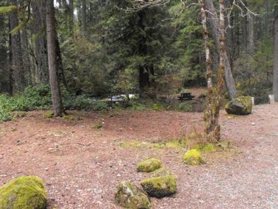
This campground has 16 sites divided into two loops along the eastern banks of the river by Olallie Creek. No electric hookups are available at the campground. Picnic tables, vault toilets and drinking water are among the amenities available. A camp host is on-site, and firewood is available for purchase.

Natural Features

Olallie Campground is located in the midsection of the Cascades mountain range in western Oregon. All campgrounds are nicely shaded by Douglas fir, maple and alder. The Willamette National Forest stretches for 110 miles with varied landscapes of high mountains, narrow canyons, cascading streams, and wooded slopes.

Reservation

More from CampingHiking.net:

DAM SITE RIVER (BEAVER LAKE), Arkansas Campground Images, Info & Reservations

Listen Directions From Eureka Springs, Arkansas, take Highway 62 West and travel just over 4 miles. Turn left on Highway 187 and continue for about 6 miles. Take the first right after crossing the dam and follow signs to the campground. Phone 479-253-9865 Activities BOATING, CAMPING, FISHING, HIKING, WATER SPORTS,

MALLARD MARSH CAMPGROUND, Oregon Campground Images, Info & Reservations

Listen Directions From Bend, travel 35.5 miles southwest on Cascade Lakes Hwy (46), then 1.3 miles east on Forest Road 4625. South Campground will come up on the right side first and then Mallard Marsh. Phone 541-323-1746 Activities CAMPING Keywords Related Link(s) Rec Area Info & Images Oregon State Tourism

HIDEOUT CANYON BOAT-IN CAMPGROUND, Utah Campground Images, Info & Reservations

Listen Directions From Manila, Utah: Take State Route 44 southeast for 7 miles. Turn northeast onto Forest Road 092, and continue to Sheep Creek Bay Boat Ramp. Once on the water, travel 2 miles southeast to reach the campground. Phone 801-226-3564 Activities BIKING, BOATING, CAMPING, FISHING, HIKING, SWIMMING SITE Keywords

UPPER WOLF CREEK GROUP, Arizona Campground Images, Info & Reservations

Listen Directions From Phoenix, Arizona: Traveling Northbound on I-17 take Exit 262 onto Hwy 69 North to Prescott and cointnue on Hwy 69 for 41 miles. Turn onto South Mt. Vernon Avenue (a.k.a Senator Highway) and drive south for about 6 miles. Pass the entrance to Goldwater Lake and the

MAMMOTH POOL, California Campground Images, Info & Reservations

Listen Directions From Fresno, California, take Highway 41 north. Turn northeast on Forest Road 200 and pass through North Fork. Take Minarets Road east, follow it 37 miles, turn right on Mammoth Pool Road and follow it 4 miles to Mammoth Pool Campground. Phone 559-642-3212 Activities BOATING, CAMPING, FISHING, HIKING,