TWELVE MILE FLAT, UT Campground Reservation, Info, Images, Map, Directions

TWELVE MILE FLAT, Utah Campground Images, Info & Reservations

Listen

Directions

Travel east up Twelve Mile Canyon on Forest Development Road 22 for approximately 20 miles, or travel west up Ferron Canyon on Forest Development Road 22 for 31 miles.

Phone

435-384-2372

Activities

BIKING, CAMPING, HIKING, HUNTING, WILDLIFE VIEWING

Keywords

TWEM,MANTI-LASAL NF -FS

Related Link(s)

Rec Area Info & Images

Utah State Tourism

Utah State Road Conditions

Overview

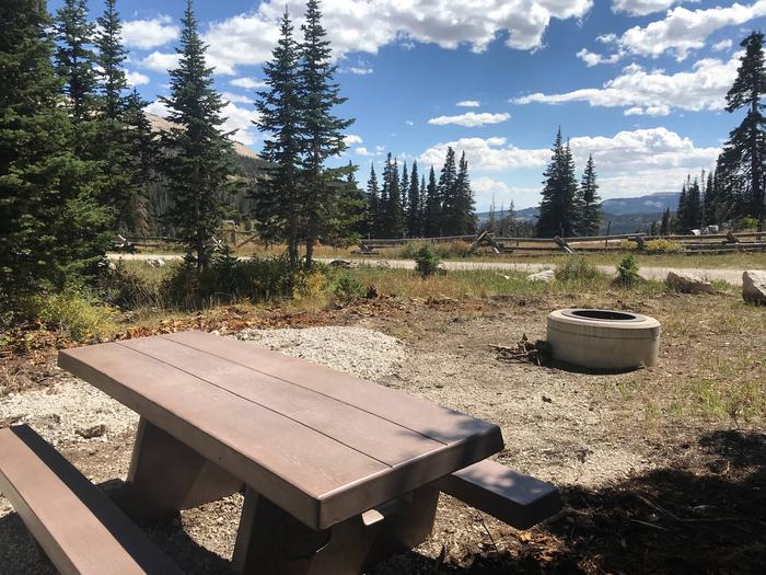
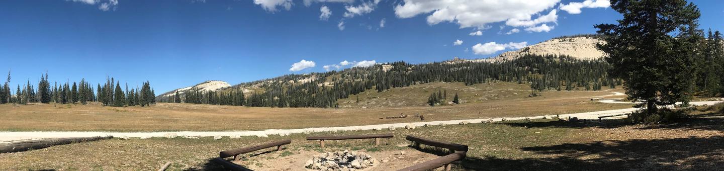
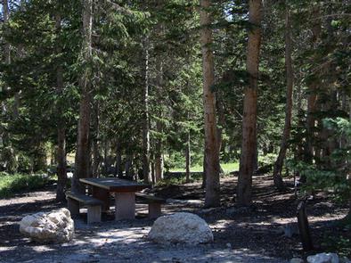
Twelve Mile Flat Campground is located beneath the shadow of Mt. Baldy near the top of the Wasatch Plateau in an open, wildflower-filled meadow surrounded by spruce and pines.

Recreation

ATV trails are abundant in the area, providing exciting riding for all skill levels. Skyline Drive passes just above the campground.

A short, but steep drive over the ridge leads to Ferron Reservoir for canoeing and rainbow and cutthroat trout fishing.

Facilities

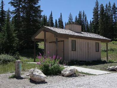
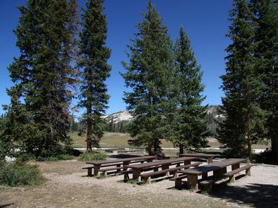
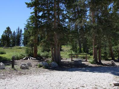
The campground contains two group sites that can accommodate up to 50 people and eight vehicles each. Additional single-family sites are also available. Vault toilets are provided, but no garbage service. Roads and parking spurs are gravel.

Natural Features

The campground sits high on the Wasatch Plateau just below the ridgeline and west of Skyline Drive at an elevation of 10,120 feet. Mature spruce and pine trees dot the open landscape, providing partial shade in the campground. Wildlife and summer wildflowers are plentiful, and autumn leaves put on a spectacular show in the surrounding area.

Nearby Attractions

Skyline Drive runs along the top of the Wasatch Plateau for 60 plus miles, rewarding visitors with beautiful mountain scenery, glacial cirques, spruce-fir forests, aspen forests and numerous lakes and reservoirs.

Reservation

More from CampingHiking.net:

RIVERSIDE CAMPGROUND, Oregon Campground Images, Info & Reservations

Listen Directions From Sisters, OR: Travel 9.6 miles northwest on Highway 20, then 4.4 miles north on Forest Road 14. Phone 541-323-1746 Activities CAMPING Keywords Related Link(s) Rec Area Info & Images Oregon State Tourism Oregon State Road Conditions Overview Located on the upper Metolius River, Riverside Campground is one

Creek Pasture Group Site, Utah Campground Images, Info & Reservations

Listen Directions Turn west off US 191 onto Highway 211 and travel approximately 27 miles. The turn off to the campground is on the north side of the highway. It is located approximately 7.5 miles southeast of the Canyonlands National Park visitor’s center and 14.5 miles northwest of Newspaper Rock.

WALKER CABIN, Idaho Campground Images, Info & Reservations

Listen Directions From State Highway 14, turn south on Crooked River Road #233 and proceed approximately 8 miles to the cabin on the right. Phone 208-842-2245 Activities BIKING, CAMPING, FISHING, HIKING, HUNTING, WILDLIFE VIEWING Keywords WALB,NEZPERCE NF – FS Related Link(s) Rec Area Info & Images Idaho State Tourism Idaho

SIX MILE CREEK, Alabama Campground Images, Info & Reservations

Listen Directions From Selma, Alabama, follow US-41 south for 9 miles. Turn right on County Road 139 and follow the signs into the campground. Phone 334-872-9554 Activities BOATING, CAMPING, FISHING, HUNTING Keywords SIXM,ALABAMA RIVERS,ROBERT F. HENRY,MILLERS FERRY LAKE,WILLIAM DANNELLY,ALABAMA RIV. – DAN Related Link(s) Rec Area Info & Images Alabama

RIVERSIDE (KS), Kansas Campground Images, Info & Reservations

Listen Directions From Salina, KS: Take HWY 140 19 miles west to HWY 141. Travel 14 miles south on 141, then 1/2 mile east on Riverside Drive. Look for signs to the park. From Ellsworth, KS: Take HWY 140 15 miles east to HWY 141. Travel 14 miles South on