


Directions
Note: Do not rely exclusively on your mobile GPS, Google Maps or similar automated navigation systems to get to the Mammoth Cave Campground. Routes can be misleading and incorrect.
Directions from the North: Take Interstate 65 to Exit 53 (Cave City Exit). Turn right onto KY-70. Follow 70/255 as it becomes the Mammoth Cave Parkway in the park. Follow the Mammoth Cave Parkway to the Visitor Center. Once in the Visitor Center parking lot turn right into the Picnic Area.
Directions from the South: Take Interstate 65 to Exit 48 (Park City Exit). Turn left onto KY-255 and follow 255 as it becomes the Park City Road into the park. Follow Park City Road until it joins the Mammoth Cave Parkway; turn left. Follow the Mammoth Cave Parkway to the Visitor Center. Once in the Visitor Center parking lot turn right into the Picnic Area.
Phone
270-758-2424
Activities
HIKING, PICNICKING, DAY USE AREA, ENVIRONMENTAL EDUCATION, PHOTOGRAPHY, BIRDING, MUSHROOM PICKING
Keywords
Mammoth Cave National Park,mammoth pavilion
Related Link(s)
National Park Services Concessionaire
Kentucky State Road Conditions
Overview
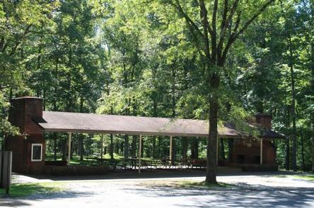
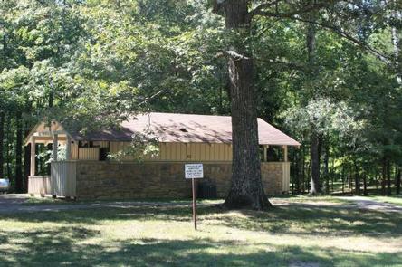
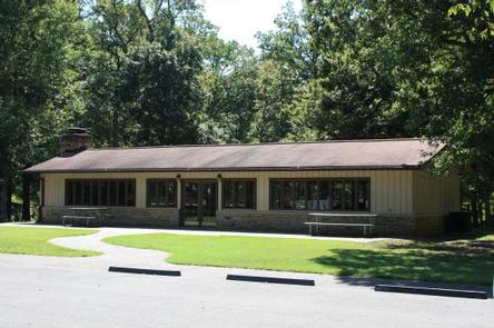
There are three shelters available at the Mammoth Cave Picnic Area for visitor use, two of which can be reserved.
- Shelter G-1 in Picnic Area is an Enclosed Shelter
- Shelter G-2 in PIcnic Area is an Open Ohelter
The shelters are within Mammoth Cave National Park, which is best known for its cave that extends over 400 miles. The cave formation began millions of years ago when mildly acidic groundwater dissolved on beds of limestone, creating subterranean passages. Native inhabitants of the cave include bats, spiders, and blindfish.
Recreation
Picnicking, enjoying the outdoors, and exploring the caves are of primary interest to visitors. The site has trailheads to the Green River Bluffs Trail and the Dixon Cave Trail. Both hiking trails are about a mile long.
Facilities
The picnic shelters are across from the Visitor Center parking lot, nestled in the Picnic Area. Each shelter is equipped to accommodate up to 60 people. Choose from the enclosed shelter or the open shelters, and enjoy the grassy surrounding area as well.
Natural Features
The picnic shelters are surrounded by oak, elm, and maple trees in the Green River Valley. The park sits above the labyrinth of underground caves and extends out over rolling hill country.
Nearby Attractions
The Green River is where anglers can fish for perch, bass and bluegills, and where kayakers can paddle past lush, tree-lined banks. Any part of Mammoth Cave National Park’s 52,800 acres is worth exploring through trails or scenic drives.
Charges & Cancellations
For rules and reservation policies please follow the link below:
https://www.recreation.gov/rules-reservation-policies