
Directions
Death Valley is in eastern California on the Nevada border, 130 miles west-northwest of Las Vegas, Nevada and 106 miles east of Lone Pine, California. Furnace Creek Campground is a half-mile north of Furnace Creek Visitor Center on State Highway 190.
Phone
760-786-2441
Activities
BIKING, HISTORIC & CULTURAL SITE, CAMPING, HIKING, PICNICKING, VISITOR CENTER
Keywords
CG12,Furnace Creek,DEATH VALLEY
Related Link(s)
California State Road Conditions
National Park Services Concessionaire
Overview
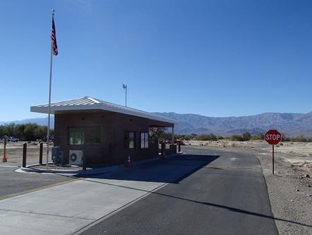
Furnace Creek Campground is in a central location in Death Valley National Park. It is popular for RV and group camping; tent sites are also available. A visitor center, bike path, hiking trails and an abandoned borax mine are nearby.
Death Valley is one of the lowest areas of land on Earth; Furnace Creek is at an elevation of 196 ft. below sea level. The region is generally sunny, dry and clear throughout the year. Winter (November through March) is the park’s peak season; temperatures are mild with occasional winter storms, and visitors should bring warm clothing and light or medium jackets. Summers are known for their extremely hot and dry conditions; temperatures can soar up to 120 degrees. Sun-protective clothing and a broad brimmed hat are recommended. Rainfall averages less than two inches per year.
Furnace Creek is the only campground in the park that takes reservations. Weekends over the winter holidays and spring break book up early; visitors should consider weekday reservations if their desired weekend is full.
Recreation
Explorers of all ages can enjoy educational programs and exhibits at the visitor center adjacent to the campground. Birders may have luck spotting local and migratory birds around the campground and along Airport Road, especially in the cooler months. Visitors can access a paved bike path within the facility. Trails to a natural bridge, the Golden Canyon badlands and the salt flats of Badwater Basin, the lowest point in North America, are a short drive away. Some of these attractions are reachable via a dirt road.
Facilities
Furnace Creek has 136 campsites with drinking water, picnic tables, flush toilets and a dump station. RVs can get drinking water at the dump station, while tent campers can get it in the campground. Each site has either a campfire ring or grill. A campground host lives on the grounds during winter.
Natural Features
Death Valley has sunk below sea level through geologic processes over time. It lies within the Mojave Desert and is the hottest, driest and lowest location in North America. Yet despite its extreme conditions, the park boasts a diversity of ecosystems, including colorful badlands, snow-covered peaks, desolate sand dunes, rugged canyons and flat, dry basins called playas.
Furnace Creek is on the edge of a playa at the bottom of the valley floor. It is fairly open with sparse vegetation, though some sites do have trees that provide shade. The facility offers a wide view of the mountains to the east and west, which glow with hues of orange, red and yellow during sunrise and sunset.
Nearby Attractions
Visitors can bike or walk along a one-mile bike path to an interpretive trail leading to the Harmony Borax Works, an abandoned borax refinery from the late 1800s. The Borax Museum is also nearby inside the Furnace Creek Ranch.
Charges & Cancellations
Reservation Cancellations & Changes
Cancelling a Reservation: Customers may cancel their reservation prior to arrival both on-line and through the call center. A $10 service fee will be withheld from any refund for a cancellation. Depending on when you cancel in relation to your arrival day, it may be considered a late cancellation (see below).
Changing an Existing Reservation: When changes are made prior to the cut-off window:
If a customer wants to switch dates that are entirely outside of the original reservation dates, there is a $10 change fee.
There is no change fee if a customer extends or shortens a reservation, as long as the change includes dates from the original reservation. If they choose to depart early, they may forfeit the recreation fee for the day of departure.
There is no change fee if the customer wants to switch sites that are the same price with the same reservation dates in the same facility.
If a reservation is made that includes dates beyond the maximum booking window, that reservation cannot be changed until 18 days have passed from the original booking date.
Late Cancellations or Cancellations within the Cut-off Window
Individual Campsites: A customer who cancels a reservation the day before or on the day of arrival will pay a $10.00 service fee AND forfeit the first night’s use fee (not to exceed the total paid for the original reservation). Cancellations for a one-night reservation will forfeit the entire amount paid and will not be subject to an additional service fee.
No-Shows
Overnight and Day-Use Facilities: A no-show customer is one who does not arrive at a campground and does not cancel the reservation by check-out time on the day after the scheduled arrival date (or for day-use facilities, by check-in time the day of arrival). Staff will hold a campsite until check-out time on the day following the arrival date.
No-shows are assessed $20.00 service fee and forfeit the first nights recreation fee for a campsite.
Early Departures
If a customer departs prior to the scheduled check-out date, they may be eligible for a partial refund.
Please notify staff at the facility if you depart early to allow others to use the site.
Customers may notify the call center to request a refund of remaining unused nights. If a customer requests a refund for an early departure after the facility check-out time has passed, the customer will not be refunded for that night and is eligible for a refund on any additional nights that will not be used.