BALD RIDGE CREEK, GA Campground Reservation, Info, Images, Map, Directions

BALD RIDGE CREEK, Georgia Campground Images, Info & Reservations

Listen

Directions

From Atlanta, GA, take SR 400 N to Exit 16, turn right on Pilgrim Mill Rd., turn right on Sinclair Shoals Rd., turn left on Bald Ridge Rd. Follow signs into campground.

Phone

770-889-1591

Activities

BIKING, BOATING, CAMPING, FISHING, SWIMMING SITE, KAYAKING, WATER ACCESS

Keywords

BALR,LAKE LANIER,BALD RIDGE,BALL RIDGE,LAKE SIDNEY LANIER

Related Link(s)

Rec Area Info & Images

Georgia State Road Conditions

Georgia State Tourism

Overview

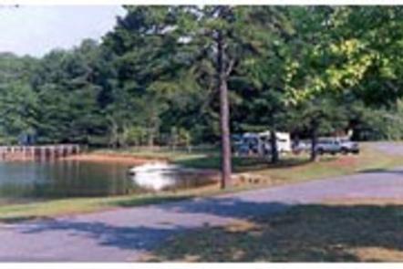
Bald Ridge Creek Campground is on Lake Sidney Lanier, popular for its aqua-blue waters and spectacular scenery. Each year, over 11 million visitors travel to Lake Sidney Lanier for fantastic fishing and boating on the beautiful reservoir in northern Georgia.

Recreation

Bald Ridge Creek Campground offers many outdoor recreation opportunities including fishing, swimming, and bike riding. On the lake there are opportunities for wake boarding, kayaking, boating and much more. There’s also a swimming beach and boat ramp available for campers.

Facilities

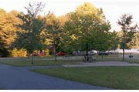
The 82 campsites come with electric and water hookups (no sewer hookups). Additional conveniences in the well-maintained park include a dump station, laundry facilities, and restrooms/bathouses.

Natural Features

Lake Sidney Lanier is nestled in the foothills of the Georgia Blue Ridge Mountains. The lake features 692 miles of shoreline and spans 38,000 surface water acres and 17,000 acres of lush terrain. The reservoir was created in 1956 with the completion of Buford Dam on the Chattahoochee River.

Nearby Attractions

By boat, there’s plenty of coves and islands to explore on the lake. For land activities, head to the Sawnee Mountain Preserve for hiking, rock climbing and an interactive visitors center for kids. The city of Cumming is nearby and has shopping, restuarants, a fairground and much more.

Charges & Cancellations

Cancellations must be made via the online/phone reservation system or in person at the gatehouse. Cancellation calls to the gatehouse will not be honored.

Reservation

More from CampingHiking.net:

VERMILLION, California Campground Images, Info & Reservations

Listen Directions From Clovis, take Highway 168 east to Shaver Lake. Continue through Shaver Lake to Huntington Lake. At the east end of Huntington Lake, turn right on the Kaiser Pass Road (at Eastwood Visitor Center). Travel 17 miles to the Edison Lake Road. Turn left toward Edison Lake and

LIZ CREEK CABIN, Idaho Campground Images, Info & Reservations

Listen Directions There are no services located on the district, so travelers should have plenty of gas, food and water for their visit, including planning for possible emergency situations. The travel route to the cabin can be quite challenging even treacherous at times, as the gravel roads on the district

WAXMYRTLE CAMPGROUND, Oregon Campground Images, Info & Reservations

Listen Directions From Florence, OR, travel seven miles south on Highway 101 to the Siltcoos Beach Access Road. Turn right on Siltcoos Beach Access Road and proceed one mile west to Waxmrytle Campground. Turn south (left); the campground entrance is the bridge on the south side on the Siltcoos Beach

PICKENSVILLE CG (PICKENSVILLE AL), Alabama Campground Images, Info & Reservations

Listen Directions From Tuscaloosa, Alabama, take Highway 82 west to the junction with Highway 86. Turn left on 86 west to Pickensville. The entrance road to the campground is 2.5 miles from the yellow caution light. Phone 205-373-6328 Activities BIKING, CAMPING, INTERPRETIVE PROGRAMS, FISHING, HIKING, HUNTING, WILDLIFE VIEWING Keywords PICK,TENNESSEE-

SILVERTIP CABIN, Montana Campground Images, Info & Reservations

Listen Directions From Hungry Horse, drive east on Highway 2 to Martin City, then south on Forest Road 38. Drive about 55 miles on a winding, gravel road, along Hungry Horse Reservoir. At the junction with Diamond R Guest Ranch, turn east on Forest Road 568 and travel approximately 15

GILL POINT, South Carolina Campground Images, Info & Reservations

Listen Directions From Lincolnton, GA, travel approximately 12 miles north on SR-79. Phone 800-5333478 Activities BOATING, DAY USE AREA, SWIMMING SITE, ACCESSIBLE SWIMMING Keywords GILL,J STROM THURMOND LAKE Related Link(s) Rec Area Info & Images Georgia State Tourism Georgia State Road Conditions Overview Gill Point Recreation Area is a rural