HICKORY CREEK, TX Campground Reservation, Info, Images, Map, Directions

HICKORY CREEK, Texas Campground Images, Info & Reservations

Listen

Directions

Due to construction on the I-35E bridge, the directions to the campground have changed if approaching from the north. Take I-35E south to Exit 460 – Meadow Oaks Rd/ Corinth Parkway. Stay on the I-35E access road heading south, go through the red light at Swisher Rd. Turn right onto Ventana Rd, go to the stop sign and turn left onto Point Vista Road. The campground is 1201 Point Vista Road, Hickory Creek, TX 75065.

Phone

469-645-9100(NOT FOR RESERVATIONS)

Activities

BOATING, CAMPING, FISHING, HIKING, DAY USE AREA

Keywords

HIC1,LEWISVILLE LAKE,LAKE DALLAS,GARZA LITTLE ELM,LEWISVILLE LAKE

Related Link(s)

Rec Area Info & Images

Texas State Tourism

Texas State Road Conditions

Overview

Hickory Creek sits on the extremely popular Lewisville Lake near Dallas, Texas. The almost 30,000-acre reservoir attracts a fair amount of visitors in summer months with warm water temperatures and excellent fishing opportunities.

Recreation

Visitors at Lewisville Lake enjoy picnicking, swimming, boating, fishing and relaxing. Photographers will stay entertained with wildlife and colorful sunsets, while hikers and bikers like to explore the 50 miles of natural surface and paved trails surrounding the lake.

Facilities

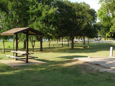
The large campground boasts 121 sites with electric hookups. Tent primitive walk-in sites are not available at this time. Park amenities include hot showers, a dump station, and boat ramp.

Natural Features

The lake stems from the Elm Fork of the Trinity River in northern Texas, and offers little visibility, but plenty of room for boating and watercraft.

The park sits on the Hickory Creek Arm of Lewisville Lake, very near to the suburbs of Dallas, Texas.

Nearby Attractions

Several public golf courses are located around the lake, and horseback riding opportunities are available, too. Hickory Creek is just 35 miles away from downtown Dallas.

Reservation

More from CampingHiking.net:

JEFFERSON SPRINGS, Tennessee Campground Images, Info & Reservations

Listen Directions From downtown Nashville, TN, take I-24 east to Sam Ridley Parkway. Turn left onto Jefferson Pike and the Recreation Area will be on the left. Phone 615-889-1975 Activities BOATING, FISHING, HIKING, WILDLIFE VIEWING Keywords JEFS,J. PERCY PRIEST,PERCY PRIEST LAKE,J PERCY PRIEST DAM Related Link(s) Rec Area Info &

MARSHALL PARK, Colorado Campground Images, Info & Reservations

Listen Directions From Creede, Colorado, travel 7 miles west on Colorado Highway 149 to Forest Road 523. Take Forest Road 523 one mile to the campground entrance. Phone 719-658-0829 Activities BIKING, CAMPING, FISHING, HIKING Keywords MASH,RIO GRANDE NF- FS Related Link(s) Rec Area Info & Images Colorado State Road Conditions

BIG LARCH CAMPGROUND, Montana Campground Images, Info & Reservations

Listen Directions From the junction of Montana Highways 200 and 83 (locally referred to as Clearwater Junction), travel north on Highway 83 for approximately 15 miles to the town of Seeley Lake. Continue north on Highway 83 for 1 mile. The campground entrance is located on the west side of

TRAILS END CAMPGROUND, Minnesota Campground Images, Info & Reservations

Listen Directions From Grand Marais, Minnesota, take Gunflint Trail (County Road 12) 57 miles north. Gunflint Trail ends at Trail’s End Campground. Phone (218)388-2212 Activities BOATING, CAMPING, FISHING, HIKING Keywords TRAE,SUPERIOR NATIONAL FOREST,Saganaga Lake,Seagull Lake,Way of the Wilderness,SUPERIOR NF – FS Related Link(s) Rec Area Info & Images Minnesota State