HIGHWAY K, MO Campground Reservation, Info, Images, Map, Directions

HIGHWAY K, Missouri Campground Images, Info & Reservations

Directions

From Annapolis, MO, follow MO Highway K west for 5 miles. The park will be on the left, and is on both sides of the bridge.

Phone

573-223-7777 (CLEARWATER LAKE PROJECT OFFICE) 573-558-2202 (HIGHWAY K GATEHOUSE)

Activities

BOATING, CAMPING, FISHING, SWIMMING SITE

Keywords

HIGW,CLEARWATER LAKE,CLEARWATER LAKE

Related Link(s)

Rec Area Info & Images

Missouri State Tourism

Missouri State Road Conditions

Overview

Campers looking to enjoy a scenic stay on the clear waters of the Black River, will enjoy the calming riverside atmosphere at Highway K Park.

Recreation

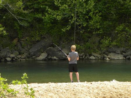
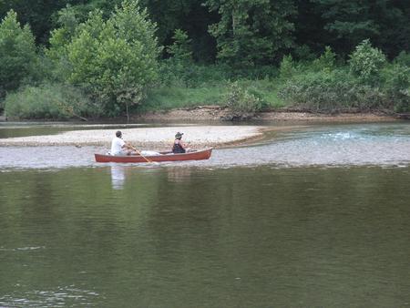
Fishing and canoeing are very popular on the river, where campers also enjoy wading out into the clear waters during warmer months.

Facilities

The campground offers 83 sites, including many with electric hookups and some sites with water hookups. Additional amenities include a dump station, hot showers, a picnic shelter and playground.

Natural Features

Highway K is a few miles upstream of Clearwater Lake on the Black River. Campsites extended over both sides of the river bank, in a lush, wooded area of mixed hardwoods.

Nearby Attractions

The Elephant Rocks State Park, Johnson Shut-ins State Park, and the historic Civil War site at Fort Davidson State Park make for an interesting, scenic day trip.

Reservation

More from CampingHiking.net:

LAKEVIEW BIGHORN, Wyoming Campground Images, Info & Reservations

Directions From Worland, Wyoming, take U.S. Highway 16 east for 52 miles. Phone 406-587-9054 Activities BIKING, BOATING, FISHING, HIKING, PICNICKING, WILDLIFE VIEWING, HOTEL/LODGE/RESORT PRIVATELY OWNED, OFF ROAD VEHICLE TRAILS, KAYAKING, CANOEING, NON-MOTORIZED BOATING Keywords LAV2,BIGHORN NF – FS Related Link(s) Rec Area Info & Images Overview Lakeview Campground is located

MAY QUEEN, Colorado Campground Images, Info & Reservations

Directions From Leadville, Colorado, head west on County Road 4. Continue on the paved road about 9 miles to May Queen Campground on the right. Phone 719-486-0749 (FOR INFORMATION ONLY, NO RESERVATIONS Activities BOATING, HISTORIC & CULTURAL SITE, CAMPING, FISHING, HIKING, SWIMMING SITE Keywords MAYQ,TURQUISE LAKE,TURQUOISE LAKE,PIKE AND SAN ISABEL

FAWN LAKES CAMPGROUND, New Mexico Campground Images, Info & Reservations

Directions From Red River, drive approximately 3 miles west on NM-38. Phone 435-245-6521 Activities CAMPING, FISHING, HIKING, HOTEL/LODGE/RESORT PRIVATELY OWNED Keywords CARSON NF- FS,Carson National Forest Related Link(s) Rec Area Info & Images Forest Service Concessionaire New Mexico State Road Conditions New Mexico State Tourism Overview Fawn Lakes Campground is

UINTA RIVER GROUP, Utah Campground Images, Info & Reservations

Directions From Roosevelt, Utah, take State Highway 121 north to Neola, then travel on Uinta and Ouray Indian Reservation Road to Forest Road 118. Phone 435-722-5018 Activities BIKING, CAMPING, HIKING, WILDLIFE VIEWING Keywords UNIR,ASHLEY NF – FS Related Link(s) Rec Area Info & Images Utah State Road Conditions Utah State

MCKINNEY CAMPGROUND, Georgia Campground Images, Info & Reservations

Directions Physical address: 6659 McKinney Campground Road, Acworth, GA 30102 From I-75 take exit 278 and turn north onto Glade Road. Continue for approximately 3 miles, then turn left onto King’s Camp Road. After about a mile continue left at the fork and follow signs to the campground. Phone 678-721-6700