OLD FEDERAL, GA Campground Reservation, Info, Images, Map, Directions

OLD FEDERAL, Georgia Campground Images, Info & Reservations

Listen

Directions

Take I-85 north to I-985, take Exit 8, turn left on Hwy 347/Friendship Rd., turn right on McEver Rd., turn left on Jim Crow Rd. and follow signs to the campground.

Phone

770-967-6757

Activities

BIKING, BOATING, CAMPING, FISHING, PICNICKING, SWIMMING SITE, SWIMMING, WATER ACTIVITIES, WATER ACCESS

Keywords

OLDF,LAKE LANIER,LAKE SIDNEY LANIER

Related Link(s)

Rec Area Info & Images

Georgia State Tourism

Georgia State Road Conditions

Overview

Old Federal Campground lies on the eastern banks of Lake Sidney Lanier in Northern Georgia. Popular for its aqua-blue waters and spectacular scenery, Lake Sidney Lanier hosts over 11 million visitors annually for fantastic fishing and boating opportunities.

Recreation

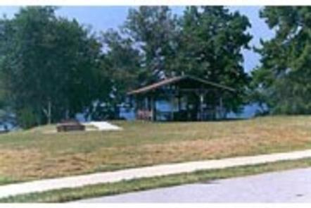
Old Federal Campground offers many outdoor recreation opportunities including fishing, swimming, picnicking and bike riding. On the lake there are opportunities for wake boarding, kayaking, boating and much more. There’s also a swimming beach and boat ramp available for campers.

Facilities

There are 65 campsites that have electric and water hookups (no sewer) and 12 primitive tent-only campsites. There are also 7 walk-in sites for those who don’t mind leaving their vehicles behind. Campers will have access to restrooms/bathouses, laundry facilities, two picnic shelters and a dump station.

Natural Features

Lake Sidney Lanier is nestled in the foothills of the Georgia Blue Ridge Mountains. The lake features 692 miles of shoreline and spans 38,000 surface water acres and 17,000 acres of lush terrain. The reservoir was created in 1956 with teh completion of Buford Dam on the Chattahoochee River.

Nearby Attractions

Lake Lanier Islands as well as other nearby Army Corps and county parks provide may different recreation opportunities at the lake. The nearby city of Gainesville provides many opportunities for those looking to explore the local area.

Charges & Cancellations

Cancellations must be made via the online/phone reservation system or in person at the gatehouse. Cancellation calls to the gatehouse will not be honored.

Reservation

More from CampingHiking.net:

BERGER, California Campground Images, Info & Reservations

Listen Directions From Sierraville, drive 18 miles south on Highway 49, turn right at Bassett, and drive approximately 1.5 miles to the Sardine Lake turnoff. Turn right at the Packer Lake turnoff (Forest Road 93) and continue to the campground. Phone (530)478-6253 Activities BIKING, BOATING, CLIMBING, CAMPING, HIKING, HORSEBACK RIDING,

AMITY RECREATION AREA, Georgia Campground Images, Info & Reservations

Listen Directions From Thomson, Georgia, take U.S. Highway 78 west for 6 miles. Turn right on State Route 43 and continue for about 7.5 miles. The park is on the right (look for signs). The park is located on the McDuffie/Lincoln County line. Phone 800-533-3478 Activities BOATING, FISHING, PICNICKING, WILDLIFE

DENT ACRES, Idaho Campground Images, Info & Reservations

Listen Directions From Hwy 12: Cross the bridge at Orofino and turn left onto Hwy 7.  Travel 200 yards and turn right on Dent Bridge Road and travel 19 miles.  At the sign for the campground, turn left.  Campground is 2 miles ahead. Phone 208-476-9029 Activities BOATING, CAMPING, FISHING, HIKING,

UNION GROVE, Texas Campground Images, Info & Reservations

Listen Directions From Interstate 35 in Salado, Texas take the Farm-to-Market Road 2484 exit. Travel west on 2484 about five miles to Union Grove Park Road, and turn right into the facility. Phone 254-947-0072 Activities CAMPING, SWIMMING SITE Keywords UNIO,STILLHOUSE HOLLOW RESERVOIR,STILLHOUSE LAKE,LAKE STILLHOUSE,STILLHOUSE HOLLOW LAKE,LAKE STILLHOUSE HOLLOW,UNION GROVE WEST,STILLHOUSE

BEAUTY CREEK CAMPGROUND, Idaho Campground Images, Info & Reservations

Listen Directions From Coeur d’Alene, Idaho, go east on I-90 to exit 22, then turn south on ID-97. Drive 2.5 miles to Forest Road 438 and turn left. Go one mile and look for signs. Phone 435-245-6521 Activities BIKING, BOATING, CAMPING, FISHING, HIKING, WATER SPORTS, SWIMMING SITE, MOUNTAIN BIKING, KAYAKING,

TANNERY, California Campground Images, Info & Reservations

Listen Directions Take I-5 to Redding, take 299 west to Weaverville, take a right on Highway 3 and go about 11 miles. The campground sign is on the left, but turn right to enter. Take 101 to Eureka, take 299 east to Weaverville, take a left on Highway 3 and