PINE RIDGE, AR Campground Reservation, Info, Images, Map, Directions

PINE RIDGE, Arkansas Campground Images, Info & Reservations

Listen

Directions

From DeQueen, AR, take Highway 71 north for 3 miles. Turn west onto DeQueen Lake Road and continue for 5.5 miles, then turn west again onto County Road and follow signs into the campground.

Phone

870-642-6111

Activities

BOATING, CAMPING, FISHING, HUNTING

Keywords

PINR,DEQUEEN LAKE,DEQUEEN LAKE

Related Link(s)

Rec Area Info & Images

Arkansas State Road Conditions

Arkansas State Tourism

Overview

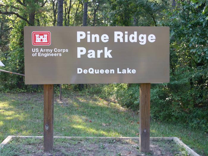
Pine Ridge Campground sits along the shores of DeQueen Lake in southwest Arkansas.

Recreation

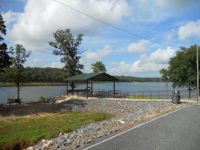
Boating and water sports top the list of recreational actives at the lake, and several boat ramps are provided for campers.

Fishing is also a popular pastime, with large mouth bass, small mouth bass, spotted pass, black and white crappie, channel and flathead catfish and various species of sunfish available in abundance. The Arkansas Game and Fish Commission have also stocked hybrid striped bass in the lake.

There are plenty of opportunities for hunting on the lands around the lake. Except for developed recreation areas and lands in the vicinity of the dam, all project lands are open to the public for hunting. Game species include bobwhite quail, mourning dove, turkey, fox squirrel, gray squirrel, cottontail rabbit and deer.

Although DeQueen Lake does not have a designated hiking trail, the vast expanse of land is open to the public and hiking activities are welcomed anywhere on project lands.

Facilities

Pine Ridge Campground offers 45 spacious campsites, along with one large reservable group picnic shelter. Campsites include modern amenities like flush toilets, showers and drinking water.

Natural Features

DeQueen Lake is part of a dam project located on the Rolling Fork River. The dam, completed in 1977, was built for flood control and water supply, and now provides a recreational oasis for thousands of campers each year.

The lake boasts 32 miles of shoreline to its visitors, along with 8,700 acres of rolling green landscape.

Nearby Attractions

The nearby town of DeQueen, Arkansas, offers gas, grocery and medical services.

Reservation

More from CampingHiking.net:

BERGER, California Campground Images, Info & Reservations

Listen Directions From Sierraville, drive 18 miles south on Highway 49, turn right at Bassett, and drive approximately 1.5 miles to the Sardine Lake turnoff. Turn right at the Packer Lake turnoff (Forest Road 93) and continue to the campground. Phone (530)478-6253 Activities BIKING, BOATING, CLIMBING, CAMPING, HIKING, HORSEBACK RIDING,

RED CANYON, Utah Campground Images, Info & Reservations

Listen Directions Located on Forest Road 095/Red Canyon Road off Highway 44, approximately 40 miles north of Vernal, Utah. Phone 435-784-3445 Activities BIKING, BOATING, CAMPING, FISHING, HIKING, WILDLIFE VIEWING Keywords RECA,RED CANYON COMPLEX,FLAMING GORGE,ASHLEY NF – FS,Flaming Gorge National Recreation Area Related Link(s) Rec Area Info & Images Utah State

WISHON, California Campground Images, Info & Reservations

Listen Directions From Highway 99, turn east on 190. Travel on 190 through Springville to Wishon Drive/M208. Turn left on Wishon Drive and travel about 4 miles. The entrance to Wishon Campground is on the right as the road curves to Doyle Springs. Phone 559-539-5230 Activities CAMPING, FISHING, HIKING Keywords

Windy Point Campground, Washington Campground Images, Info & Reservations

Listen Directions From Naches, Washington, take Route 12 west for 4.4 miles to the intersection with State Route 410. Turn left at the intersection, staying on Route 12. Travel 8 miles to campground on the left. Phone 541-338-7869 Activities CAMPING, FISHING, HIKING Keywords WIND,RIMROCK LAKE,TIETON RIVER,OKANOGAN – WENATCHEE NF -FS

JARVIES BOAT IN GROUP, Utah Campground Images, Info & Reservations

Listen Directions Cedar Springs Marina is the closest boat ramp to Jarvies. Jarvies Canyon is the first canyon west and a little north of the marina and is only accessed by boat. From Vernal, Utah, take U.S. 191 north 42 miles. Turn north onto Forest Road 183 and travel approximately