TOWN CREEK CAMPGROUND - WEST POINT - MS, MS Campground Reservation, Info, Images, Map, Directions

TOWN CREEK CAMPGROUND – WEST POINT – MS, Mississippi Campground Images, Info & Reservations

Listen

Directions

From Columbus, Mississippi, take Highway 45 north to the junction with Highway 50. Turn left and follow 50 west past the Tenn-Tom Waterway bridge. Two miles west of the bridge, turn north onto Town Creek Road and follow the signs.

Phone

662-494-4885

Activities

BIKING, BOATING, CAMPING, FISHING, HIKING, HUNTING, WILDLIFE VIEWING

Keywords

TOWN,TENNESSEE-TOMBIGBEE WATERWAY,TENN-TOM,TOWN CREEK,TENNESSEE-TOMBIGBE

Related Link(s)

Rec Area Info & Images

Mississippi State Tourism

Mississippi State Road Conditions

Overview

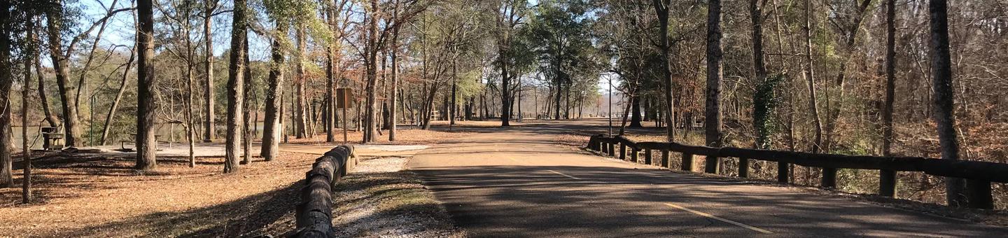
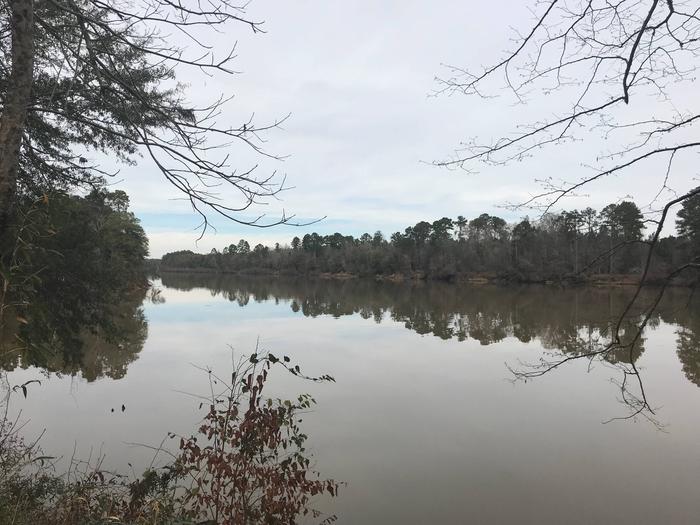
Town Creek Campground is located on the beautiful Columbus Lake in the Tennessee-Tombigbee Waterway.

The campground has direct access to the waterway for recreational boating activities and is a great place to relax and view the scenery.

Recreation

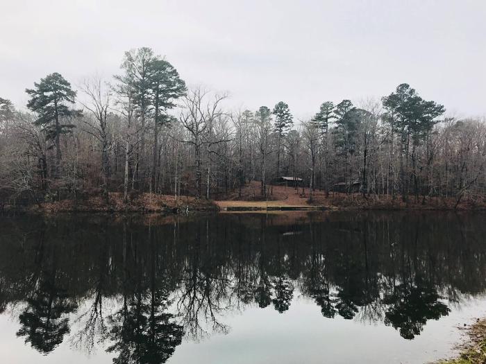
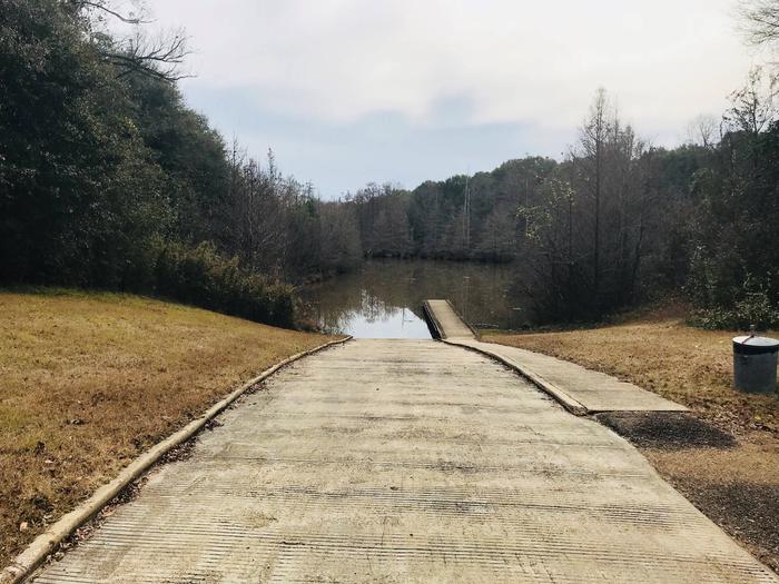
With Columbus Lake and Kennedy Lake to explore, this facility has ample water recreation opportunities.

Anglers can try their luck on the fishing dock or head off-shore in search of bass, catfish and crappie.

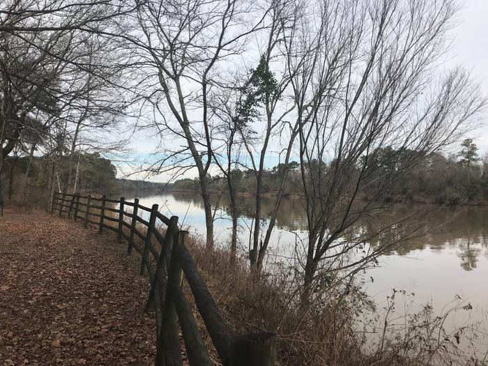
Families with children can play on the facility’s three playgrounds and go hiking, biking or birding. The nature trail circling the Kennedy Lake crosses the water in a number of places by way of wooden footbridges.

Facilities

Town Creek offers 100 sites with electric and water hookups, picnic tables, fire rings with grills and lantern posts along the banks of the waterway. Campers have the convenience of hot showers and laundry facilities.

The campground also offers 10 primitive, tent-only sites along the Kennedy Lake shore.

Natural Features

The thickly forested, sloping shoreline and calm water create a peaceful atmosphere. On top of the hill overlooking the Tombigbee is Kennedy Lake; on the back of the lake, water cascades down a stone waterfall and into a creek that meanders through the park.

The Tenn-Tom, as the waterway is known, extends 234 miles from the Tennessee River to the junction of the Tombigbee River in Alabama. The man-made waterway connects the nation’s midsection of commercial water transportation with the Gulf of Mexico.

Nearby Attractions

Town Creek Campground is just minutes from the cities of Columbus and West Point, Mississippi, which offer a variety of conveniences such as shopping, restaurants and golf courses.

Reservation

More from CampingHiking.net:

CAMP MISTY MOUNT, Maryland Campground Images, Info & Reservations

Listen Directions The street address for GPS use is 14764 Park Central Road, Thurmont, MD. From Washington DC, take the George Washington Memorial Parkway north to I-495 onto I-270 north 27 miles to Frederick, MD. Take Route 15 for 17 miles north to Thurmont, MD. Take Route 77 West, the

LEWIS CANYON, Arizona Campground Images, Info & Reservations

Listen Directions Drive to Pinedale, Arizona, on State Highway 260, approximately 14 miles northwest of Show Low. Turn south on Forest Road 130 and continue approximately 2.3 miles to Junction 130A. Turn right to the group site, following the signs.  Phone 928-368-2100 Activities BIKING, CAMPING, HIKING Keywords LEWI,APACHE-SITGREAVES NF-FS Related

GRIZZLY RIDGE YURT, Utah Campground Images, Info & Reservations

Listen Directions Follow the mileage indications below and watch for signs when traveling to Grizzly Ridge Yurt. Leave with plenty of time to arrive at the yurt before dark. A high-clearance vehicle with four-wheel drive is required to access the yurt. From Vernal, Utah, travel north on U.S. Highway 191

COYOTE POINT, California Campground Images, Info & Reservations

Listen Directions From Stockton California, take Highway 26 east for 30 miles. Turn right on Hogan Dam Road and continue for a mile, then follow signs to the campground. Park Headquarters: 2713 Hogan Dam Road Valley Springs, CA 95252 Coyote Point (located in Oak Knoll Campground): 3027 South Petersburg Road

COVE GROUP, California Campground Images, Info & Reservations

Listen Directions From Fresno, California, go east on Highway 180 towards Kings Canyon National Park. Take a right on the General’s Highway and travel approximately 10 miles south to campground entrance on the left. Phone 559-335-2232 Activities CAMPING Keywords COVG,GIANT SEQUOIA NAT. MONUMENT,SEQUOIA NF – FS Related Link(s) Rec Area