FINDLEY CAMPGROUND, CA Campground Reservation, Info, Images, Map, Directions

FINDLEY CAMPGROUND, California Campground Images, Info & Reservations

Directions

Take Interstate 80 to the Truckee/Highway 89 North exit. Follow Highway 89 north for 17 miles, to the Jackson Meadows turnoff. Travel west on Forest Road 07 for 18 miles, to Jackson Meadows Reservoir. Proceed across the dam and continue on a paved/gravel road for approximately four miles. Turn left at the Woodcamp Recreation Area sign and proceed to the campground.

Phone

530-265-8861

Activities

BIKING, BOATING, CAMPING, FISHING, HIKING, HUNTING, SWIMMING SITE

Keywords

FIND,JACKSON MEADOWS RESERVOIR,SIERRAVILLE,TAHOE NF – FS

Related Link(s)

Rec Area Info & Images

California State Road Conditions

California State Tourism

Overview

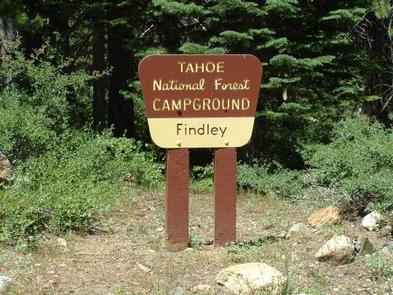
Findley Campground is located alongside the scenic Jackson Meadow Reservoir in the Tahoe National Forest. The location, part of the Woodcamp Recreation Area, makes a great base camp for a wide range of recreational activities found in the surrounding area, including boating, fishing, hiking and hunting. Findley Campground is operated by Nevada Irrigation District in cooperation with the Tahoe National Forest.

Recreation

The reservoir offers excellent opportunities for boating, canoeing, water skiing, swimming and fishing. Anglers will find rainbow and brown trout. A boat ramp and designated swim beach are located within the Woodcamp Recreation Area.

A half-mile interpretive nature trail wanders through adjacent Woodcamp Campground. A portion of the Pacific Crest Trail meanders along the east side of the lake. Hunting and biking are popular activities in the surrounding area.

Facilities

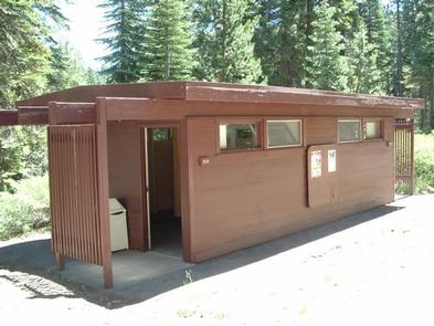
The campground offers single-family campsites, each equipped with a picnic table and campfire ring. Flushing toilets and drinking water are provided.

Natural Features

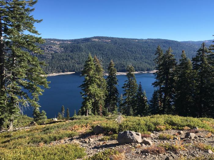
Jackson Meadow Reservoir is situated in a rolling forested valley, where visitors are awarded beautiful views of the Sierra Crest and English Mountain. The campground lies on the western shore of the lake, in a forest of pine and fir trees.

Reservation

More from CampingHiking.net:

MINERSVILLE CAMPGROUND, California Campground Images, Info & Reservations

Directions From Weaverville: take Highway 3 north for 15 miles. Turn right on Minersville/Bushtail Road for 1 mile. Phone 530-623-2121 Activities BOATING, CAMPING, FISHING, HIKING, WATER SPORTS, SWIMMING SITE Keywords Trinity Lake,Clair Engle Lake,Minersville Related Link(s) Rec Area Info & Images California State Road Conditions California State Tourism Forest Service

LOST CREEK, Oregon Campground Images, Info & Reservations

Directions From Portland, follow Highway 26 for 18 miles past the town of Sandy to the community of Zigzag. Turn north (left) onto Lolo Pass Road (Forest Road 18). Travel just over 4 miles and turn right onto Forest Road 1825. Continue for less than a mile and then bear

HAMPSHIRE ROCKS, California Campground Images, Info & Reservations

Directions From Truckee, Calif., take Highway 80 west 17 miles. Take the Rainbow/Big Bend exit. If westbound, turn left under the freeway to the campground entrance. If eastbound, turn right at the stop sign. Phone 530-478-6253 Activities BIKING, CAMPING, FISHING, HIKING, SWIMMING, WATER ACCESS, SCENIC DRIVE, HISTORIC SITES Keywords HAMP,TAHOE

TOLLGATE, Oregon Campground Images, Info & Reservations

Directions From Portland, travel southeast on Highway 26 for about 32 miles. Phone 503-630-5721 Activities BIKING, HISTORIC & CULTURAL SITE, CAMPING, FISHING, HIKING Keywords TOLL,MT. HOOD NF – FS Related Link(s) Rec Area Info & Images Forest Service Concessionaire Oregon State Road Conditions Oregon State Tourism Overview Tollgate Campground is

ECHO LAKE, Colorado Campground Images, Info & Reservations

Directions Take I-70 westbound, Idaho Springs exit #240 – Hwy 103. Go south 14 miles to the intersection of Hwy 103 and Hwy 5 (Mt Evans Road). Turn right on Hwy 5 then turn left to enter the campground. Phone 801-226-3564 Activities CAMPING, FISHING, HIKING, WILDLIFE VIEWING, SCENIC DRIVE Keywords

RAVEN CABIN, Alaska Campground Images, Info & Reservations

Directions The cabin is located 8 air miles east of Yakutat on the east bank of Situk River. Access is by trail, boat or wheeled aircraft. From Nine Mile Bridge on Forest Highway 10, hike the 3-mile trail or boat 3.2 miles downriver (1.5 hour float). The cabin is 9.6