FISH CREEK (OR), OR Campground Reservation, Info, Images, Map, Directions

FISH CREEK (OR), Oregon Campground Images, Info & Reservations

Listen

Directions

From Estacada, travel east on Highway 224 for approximately 16 miles.

Phone

503-630-5721

Activities

BIKING, BOATING, CAMPING, FISHING, HIKING, WATER SPORTS

Keywords

FLI1,MT. HOOD NF – FS

Related Link(s)

Rec Area Info & Images

Oregon State Road Conditions

Forest Service Concessionaire

Oregon State Tourism

Overview

Fish Creek Campground is ideally located next to the Clackamas Wild and Scenic River in Mt. Hood National Forest. It provides access to some of the area’s greatest whitewater, as well as a famous place to fish. Whether it is relaxation or expansive exploration, there’s something for everyone at Fish Creek.

Recreation

Fishing is very popular on the Clackamas and anglers can expect to find winter steelhead, spring chinook and late summer coho salmon, as well as other species of freshwater fish. A convenient boat ramp is available within the campground.

The Clackamas River also provides miles of wild water as it bends through the scenic Cascade Range, creating prime whitewater rafting opportunities.

A hiking trail follows the river north and south and begins within the campground. Scenic driving is available on the West Cascades Scenic Byway, which follows the river.

Facilities

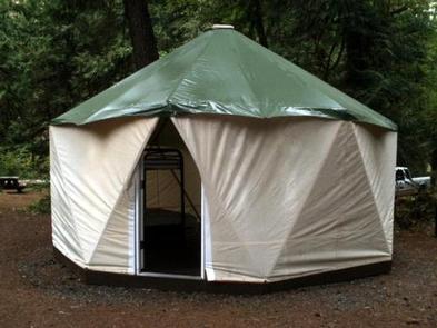
The campground offers single-family sites for tent or RV camping. Narrow roads within the campground make for tricky navigation for larger RVs.

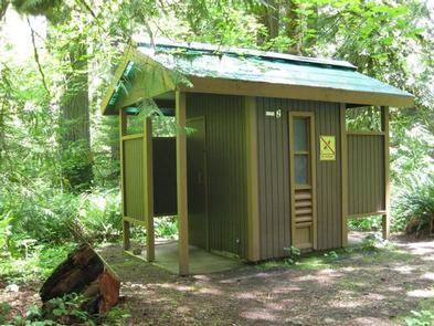
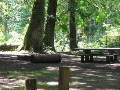
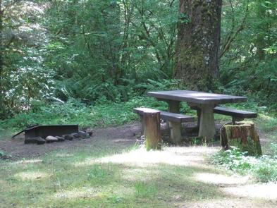
Each campsite is equipped with a table and campfire ring with grill. Accessible vault toilets and drinking water are provided, but utility hookups are not available. Parking surfaces are gravel.

Natural Features

The campground is situated along a scenic bend just above the river at an elevation of about 900 feet. It is in a heavily forested area, with a variety of bushes, ferns and grasses covering the forest floor. Vegetation provides minimal privacy within the campground, but with the river so close, noises within the campground are fairly muffled.

The river provides habitat for the federally protected bald eagle and northern spotted owl, as well as the occasional peregrine falcon. A variety of wildlife also makes its home in the area.

Nearby Attractions

The campground is located about an hour’s drive from majestic Mt. Hood, Oregon’s tallest point.

Reservation

More from CampingHiking.net:

RIDGE ROAD, Georgia Campground Images, Info & Reservations

Listen Directions From I-20 take Exit 183 (Appling). Go north on HWY 221 approximately 6 miles. At 4-way stop, go left (GA HWY 47) and drive approximately 5 miles. Campground road is on right. Follow signs. Phone 706-541-0282 Activities CAMPING, SWIMMING SITE Keywords RIDG,J STROM THURMOND LAKE Related Link(s) Rec

PLATTER FLATS, Texas Campground Images, Info & Reservations

Listen Directions From Colbert, Oklahoma, travel 5 miles north on US 75, turn west 5 miles to Platter Flats, OK, then follow signs to the campground. Physical address: 867 Trail Ride Road, Platter, OK 74753. Phone 580-434-5864 Activities CAMPING Keywords PLAT,TEXOMA LAKE,TEXOMA LAKE Related Link(s) Rec Area Info & Images

ELKS FLAT CAMPGROUND, Idaho Campground Images, Info & Reservations

Listen Directions From Mountain Home, travel east on Highway 20 for 35 miles to the turnoff for Pine/Featherville (Forest Highway 61). Travel north on Highway 61 for 24 miles to the campground. Phone 208-587-7961 Activities BOATING, CAMPING, FISHING, SWIMMING SITE Keywords ELKF,ELK FLATS,JOHNSON BRIDGE,BOISE NF – FS Related Link(s) Rec

GREENDALE, Utah Campground Images, Info & Reservations

Listen Directions From Vernal, Utah, take U.S. 191 north for about 40 miles. From Manila, Utah, take Highway 44 for 28 miles. Turn left on U.S. 191 and travel approximately 2 miles north. From Rock Springs, Wyoming, take I-80 west toward Green River about 6 miles to the junction with

BOULDER DAY USE, Illinois Campground Images, Info & Reservations

Listen Directions (Address: 25501 Boulder Access RD, Shattuc, IL 62231). From I-57, take Old U.S. Highway 50 west. Continue for 19 miles through Salem, Odin and Sandoval. Turn north on Boulder Road and follow 7 miles to the day use and recreation area. Phone 618-226-3586 Activities BIKING, BOATING, CAMPING, FISHING,