

Directions
Take Highway 12 from I-5 and proceed 40 miles to Randle, turn south on Forest Road 25 and continue for 12 miles to the campground.
Phone
541-338-7869
Activities
CAMPING
Keywords
IRCR,RANDLE,MT. ST. HELENS,GIFFORD PINCHOT NF – FS
Related Link(s)
Washington State Road Conditions
Overview
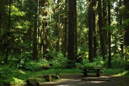
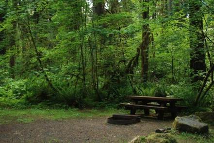
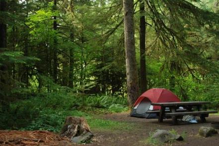
Iron Creek Campground sits near the confluence of Iron Creek and the Cispus River. This large campground winds through a forest of old-growth Douglas firs, cedars and hemlock. Lush vegetation and ample space between sites offers excellent privacy.
Recreation
Iron Creek provides great fishing for cutthroat trout, whitefish and rainbow trout.
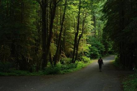
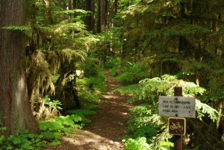
Visitors can stroll along the .3-mile Iron Creek Old Growth Trail and weave through the forest and along the Cispus River, or continue on a longer walk down the Iron Creek Campground Trail. This trail is barrier-free and designed to accommodate any age or skill level, with benches and plenty of places to stop along the way.
Facilities
There are 99 single and double family sites that are back-in and paved. Level spurs provide easy RV parking. Picnic tables, campfire rings and drinking water are provided.
Natural Features
Located in southwest Washington State, the Gifford Pinchot National Forest encompasses 1.3 million acres and includes the 110,000-acre Mount St. Helens National Volcanic Monument established by Congress in 1982.
Iron Creek is part of the Cowlitz Valley Ranger District, which is located in the northernmost portion of the Gifford Pinchot National Forest. This District is roughly located among three volcanic peaks: Mt. Rainier to the north, Mt. Adams to the east, and Mount St. Helens to the west.
Nearby Attractions
The Woods Creek Watchable Wildlife Interpretive Site is just up Forest Road 25 toward the town of Randle. Forest Road 25 is a popular scenic drive and provides excellent views of Mount St. Helens.
The Windy Ridge Viewpoint at Mount St. Helens is approximately 20 miles away.