SILVER CREEK-TRUCKEE, CA Campground Reservation, Info, Images, Map, Directions

SILVER CREEK-TRUCKEE, California Campground Images, Info & Reservations

Directions

From Truckee, travel south on Highway 89 for about 8 miles. Campground is on the left.

Phone

(530)587-3558. FOR RESERVATIONS, PLEASE CALL: 1 (877) 444-6777.

Activities

BIKING, CAMPING, FISHING, HIKING, SWIMMING SITE, MOUNTAIN BIKING, WATER ACTIVITIES, WATER ACCESS

Keywords

SICR,SILVER CREEK TRUCKEE,TAHOE NF – FS

Related Link(s)

Rec Area Info & Images

California State Road Conditions

California State Tourism

Overview

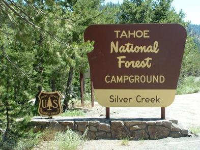
Silver Creek Campground is located on the Truckee River, off of Highway 89, between Truckee and Tahoe City. Visitors enjoy the area for its fishing and hiking opportunities, as well as its proximity to Lake Tahoe and Squaw Valley. This facility is operated and maintained by the Tahoe National Forest.

Recreation

Fly-fishing for rainbow trout in the Truckee River is a popular activity. Campers also enjoy swimming and tubing. The surrounding area offers abundamt hiking and biking trails, including the Western States Trail, Five Lakes Trail, and Pacific Crest Trail.

Facilities

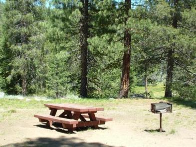
The campground offers single-family sites, seven of which are designated for tent-camping only. Each site is equipped with a picnic table, campfire ring with grill. Vault toilets and drinking water are provided.

Natural Features

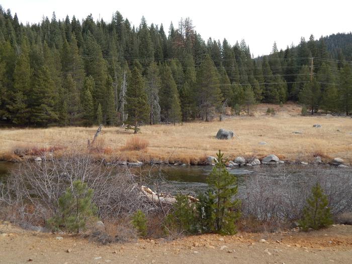
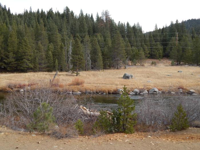
The campground is situated on the banks of the Truckee River. A few sites overlook the river. A scenic forest of lodgepole pine and fir covers the area.

Nearby Attractions

Silver Creek Campground is centrally located between Prosser, Boca and Stampede Reservoirs to the north and Lake Tahoe and Squaw Valley to the south. A variety of outdoor recreational activities is available at each location. Truckee, 10 minutes north, offers all the amenities of a year round recreational mountain town including interstate highway connectivity, top notch restaurants, resorts and hotels, grocery stores, gas stations, shopping, and historic sites. Lake Tahoe is located 10 minutes south and offers excellent boating, kayaking, fishing, hiking and scenic driving opportunities, as well as dining, shopping and lodging options. Other recreational opportunities include Donner Camp Interpretive Trail, Overland Emigrant Commemorative Trail, Stampede Reservoir Recreation Area, Prosser Pits OHV area, and numerous hiking, mountain biking, and OHV trails.

Reservation

More from CampingHiking.net:

ALAVA BAY CABIN, Alaska Campground Images, Info & Reservations

Directions The cabin is approximately 20 air miles southeast of Ketchikan on Revillagigedo Island. Accessible by floatplane, kayak or boat with mooring buoy. Navigation is challenging due to tides, merging currents and open ocean waters. Please check tide tables in advance. Refer to USGS Ketchikan A-4. Phone 907-225-2148 Activities CAMPING,

HENDERSON PARK, Arkansas Campground Images, Info & Reservations

Directions From Mountain Home, Arkansas, travel east on US Highway 62/412 10 miles to the town of Henderson. Look for park signs for the park entrance on the left. Phone 870-425-2700 Activities BOATING, CAMPING, FISHING, HUNTING, WATER SPORTS, DAY USE AREA, HOTEL/LODGE/RESORT PRIVATELY OWNED Keywords Related Link(s) Rec Area Info

EAST ROLLING HILLS PARK (KS), Kansas Campground Images, Info & Reservations

Directions Take I-70 to exit 295, then 4.5 miles north to Hwy. 57, then east approximately 1.5 miles to park entrance. Phone 785-238-5714 Activities CAMPING, WILDLIFE VIEWING, SWIMMING SITE Keywords Related Link(s) Rec Area Info & Images Kansas State Tourism Kansas State Road Conditions Overview East Rolling Hills day use

THREE LAKES, Michigan Campground Images, Info & Reservations

Directions From Strongs Corner, turn south on Forest Road 3142 and travel approximately two miles. The campground is on the east side of the road. Phone (906) 643-7900 Activities BOATING, CAMPING, FISHING, HIKING, SWIMMING SITE Keywords THRE,Three Lake Campground,Softball Campground,HIAWATHA NF – FS Related Link(s) Rec Area Info & Images

NORTH OVERLOOK PICNIC SHELTER (IA), Iowa Campground Images, Info & Reservations

Directions 1007 Hwy T15 Knoxville, Iowa 50138 From Pella, Iowa, take County Highway T-15 southwest for 3 miles, then follow signs to North Overlook Picnic Shelter. Phone 641-828-7522 Activities CAMPING, PICNICKING, BIRDING Keywords Related Link(s) Rec Area Info & Images Iowa State Road Conditions Iowa State Tourism Overview North Overlook