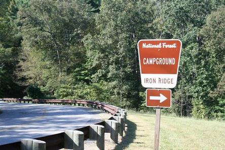
IRON RIDGE - LAKE VESUVIUS, OH Campground Reservation, Info, Images, Map, Directions

IRON RIDGE – LAKE VESUVIUS, Ohio Campground Images, Info & Reservations

Listen

Directions

From U.S. Highway 52 at Ironton, Take State Route 93 north for 6 miles to the Lake Vesuvius Road (County Road 29). Turn east toward Lake Vesuvius and travel 1 mile to the recreation area.

Phone

740-534-6500

Activities

BOATING, CAMPING, FISHING, HIKING, HUNTING

Keywords

IROR,VESUVIUS,LAKE VESUVIUS,IRON RIDGE,IRON RIDGE LAKE VESUVIUS,WAYNE NF – FS

Related Link(s)

Rec Area Info & Images

Ohio State Tourism

Ohio State Road Conditions

Overview

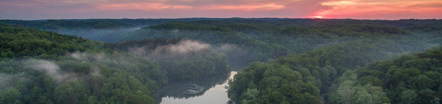
Iron Ridge is one of two campgrounds in the Vesuvius Recreation Area in southeastern Ohio’s Wayne National Forest. Iron Ridge offers a great location for outdoor recreation, with activities like boating, swimming and fishing on Lake Vesuvius. Horseback riding and hiking are also available in the rolling hills surrounding the campground.

Recreation

Boating, fishing and swimming on Lake Vesuvius are the area’s most popular activities. Anglers may catch bass, catfish, crappie or bluegill.

More than 40 miles of trails exist in the area, with trailheads beginning at or near the campground. A 1/2-mile hiking trail connects the campground to Lake Vesuvius. Lake Shore Trail offers an 8-mile loop around the lake and shorter trails lead to Rock House Cave, a grand, tunnel-like sandstone cave that was once used by Native Americans for shelter.

Facilities

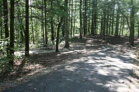
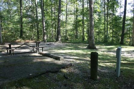
The campground offers multiple sites for RV camping, many of which have electric hookups. Some first-come, first-serve sites are also available. Each campsite can accommodate up to eight individuals.

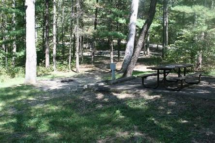
Each site is equipped with a picnic table and campfire ring with grill. The campground has accessible flush toilets, showers and drinking water. A dump station is located on-site.

Natural Features

Iron Ridge Campground is located on a wooded ridge above 143-acre Lake Vesuvius. A scenic forest of mature eastern hardwoods covers the area.

Nearby Attractions

The closest town is Ironton, Ohio, less than 10 miles from the campground.

Reservation

More from CampingHiking.net:

LAKE SPRINGS, Georgia Campground Images, Info & Reservations

Listen Directions From Augusta, GA, travel 22 miles west on GA-104, then 4 miles north on US HWY 221. Phone 800-533-3478 Activities BIKING, BOATING, FISHING, HIKING, PICNICKING, DAY USE AREA, SWIMMING SITE, SWIMMING, ACCESSIBLE SWIMMING, LOOKOUT TOWER Keywords LASC,J STROM THURMOND LAKE Related Link(s) Rec Area Info & Images Georgia

NORTH SANDUSKY DAY-USE, Illinois Campground Images, Info & Reservations

Listen Directions From I-57 take take exit 77, and turn west onto Route 154. Continue for 4.5 miles, then turn south on Rend City Road. Continue through the stop sign to the park entrance. Phone 618-724-2493 Activities BIKING, BOATING, HIKING, SWIMMING SITE, DISC GOLF Keywords NSAD,REND LAKE,NORTH SANDUSKY,NORTH SANDUSKY DAY

MATHEWS ARM CAMPGROUND, Virginia Campground Images, Info & Reservations

Listen Directions From Washington, D.C. metro area, travel west on Interstate 66 to exit 43A. Take US Highway 29 South to Warrenton, Virginia, then take US Highway 211 west for 28 miles to Shenandoah National Park and Skyline Drive Thornton Gap Entrance. Follow Skyline Drive north approximately 9 miles and

CONTORTA POINT GROUP CAMP, Oregon Campground Images, Info & Reservations

Listen Directions From Highway 58 at Crescent Lake Junction, follow Forest Road 60 for 9.3 miles around Crescent Lake. Travel 1 mile west on Forest Road 280 to the campground entrance gate. Phone 541-323-1746 Activities BIKING, BOATING, CAMPING, FISHING, HIKING, WATER SPORTS Keywords CPGC,Contorta,DESCHUTES NF – FS Related Link(s) Rec