


Directions
Access to the cabin is by float plane or boat with anchor at high tide. Flight time is approximately one hour and 15 minutes from Juneau or 30 minutes from Petersburg. Access by boat via Stephens Passage or Fredrick Sound is approximately 100 miles from Juneau. Float plane or boat access can only occur at certain stages of the tide. Please check current conditions prior to your trip. Click here for more information. Inclement weather conditions may cause an extension of your trip during any time of the year and winter access can be difficult due to snow and ice conditions. Visitors should bring extra supplies to last 2-5 days Please contact the Admiralty Island National Monument at 907-586-8800 prior to arrival for more detailed information about safety precautions.
Click here for information about reaching Forest Service Cabins.
Phone
907-586-8800
Activities
BOATING, CAMPING, FISHING, HIKING, WILDLIFE VIEWING
Keywords
PYAY,TONGASS NF – FS
Related Link(s)
Overview
Pybus Cabin offers guests recreation, relaxation and a unique wilderness lodging experience on the southeast side of Admiralty Island in the Tongass National Forest. The remote site offers a scenic setting for fishing, boating and wildlife viewing, all within the vicinity of the cabin.
Access to the cabin is float plane or boat. Visitors are responsible for their own travel arrangements and safety and must bring several of their own amenities.
Recreation
Wildlife viewing is abundant on land and in water. Pybus Bay is quite remote, and a good place for humpback whale sightings.
A game trail to Donkey Bay is accessible at high tide and seasonal commercial fishing activity is popular in Pybus Bay.
Facilities
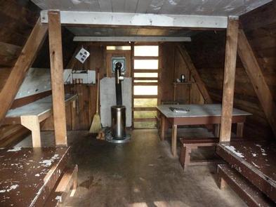
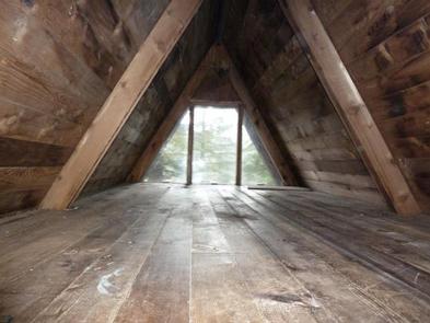
The cabin is a primitive, pre-cut cedar log cabin in A-frame style, furnished with wooden bunkbeds without mattresses and a loft that sleep up to seven guests. The cabin is equipped with a table, benches, an oil stove for heat and an outdoor toilet.
The cabin does not have running water or electricity. Visitors must bring their own food, water, sleeping bags, sleeping pads, cook stove, matches, cooking gear/utensils, light source, #1 stove oil, toilet paper, first aid kit and garbage bags.
Water is available from a nearby stream. Water from any natural site must be filtered, boiled or chemically treated before drinking.
Click here for more cabin details.
Natural Features
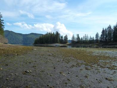
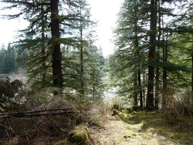
The cabin is about a half-mile north of Donkey Bay in a protected cove within Pybus Bay. The shoreline is surrounded by a thick temperate rainforest of old-growth spruce and hemlock trees, ferns, shrubs and grasses. The end of the bay has large tidal flats.
Wildlife in the area abounds, including migratory waterfowl and shorebirds, Sitka black-tailed deer and brown bears.