


Directions
Access by float plane is 45 minutes from Anchorage and 55 minutes from Cordova. By boat the trip is 25 miles from Whittier into Long Bay, then an additional one-mile hike on a trail to reach the lake. The trailhead at Long Bay is very tidal dependent and best accessed at a high tide with a small boat. Please consult the Whittier tide book or local water taxi for information. The cabin can also be accessed from the Three Fingers Trail (two mile hike to cabin) but does require a substantial river crossing (Shrode River) to access the cabin.
Boats may anchor in Long Bay. It’s advised that only small, shallow-draft vessels proceed during high tide as far as the lagoon at the head of Long Bay (trailhead). Numerous rock hazards are in the channel and lagoon.
In fall, winter, spring and early summer, the cabin may be inaccessible by float plane due to frozen lake surface. Ice has been observed on Shrode Lake as late as July. Contact local air taxi services in Anchorage and Cordova or the Glacier Ranger District office (907) 783-3242 for information prior to making reservations during these periods.
Phone
907-783-3242
Activities
CAMPING, FISHING, HIKING, HUNTING, WINTER SPORTS
Keywords
SHR1,CHUGACH NF – FS
Related Link(s)
Overview
Shrode Lake Cabin is open year-round, offering the opportunity to enjoy both summer and winter recreation in beautiful Prince William Sound. The cabin is in a secluded location that provides a true backcountry experience.
The site can be accessed by float plane or boat, depending on conditions. Those arriving by boat have two choices.
The Long Bay trailhead is only accessible at very high tides and small shore-going boats (Kayak, packraft or Dinghy).
It’s about a 1 mile hike from salt water to the Cabin from the Long Bay trailhead. If accessing the Shrode Lake Cabin from the Three Fingers trailhead, larger boats can motor into the middle (of the three) finger and will see a trailhead sign at the head of the Bay. It’s ~2 mile hike from Trailhead to the Cabin and requires a river crossing just before arriving to the Cabin. A third option (from the Three Fingers Trailhead) is to utilize the .5 mile Portage trail (between Salt Water and Shrode Lake) to carry a canoe, kayak or packraft. Then you’ll have a ~2 mile paddle along the North shore of Shrode lake to the Cabin. Guests are responsible for their own travel arrangements, safety, and must bring several of their own amenities.
Recreation
Hike on the one-mile trail to Long Bay or hike to Jack Lake (no designated trail), which is a half-mile from the cabin. Three Fingers Cove to the west of Shrode Lake can be accessed via a one and a two mile primitive trail that may require some route-finding skills. Note: This trail requires a substantial river crossing (Shrode River) before arriving at the Cabin. Depending on the water level Shrode River can be fordable in knee high rubber boots or completley unpassable (without a packraft or similar).
Anglers can fish for sockeye salmon in mid-July, a relatively small run that passes through quickly. Abundant pink salmon are available from mid-July to mid-August, and silver salmon in late August. Fishing takes place in Long Bay (saltwater), the lagoon between saltwater and Shrode Lake, and the stream that drains Shrode Lake. Dolly Varden trout are available in Shrode Lake.
Guests can use the small rowboat and oars provided by the Forest Service at Shrode Lake, but should bring their own personal floatation device. It is important to consult tide tables before boating in order to properly navigate the lagoon and avoid the numerous rock hazards in the area (local tide tables).
In season deer and bear hunting is possible in designated areas with a permit. The terrain and amount of snowfall makes for excellent cross-country and backcountry skiing in the spring months.
Facilities
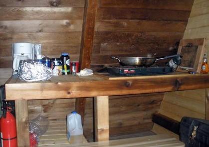
The cabin is a 16 x 16 foot A-frame with a main floor and a sleeping loft. It accommodates up to six people and comes equipped with wooden bunks, an oil drip heater (kerosene), a table, benches, broom, fire extinguisher and an outhouse with a pit toilet.
Water, electricity and fuel for the heater are not provided. Freshwater is available around the cabin, but it should be treated before drinking.
Visitors are responsible for bringing their own drinking water, kerosene for heater (typically a gallon/ day is sufficent), a cook stove, flashlights or lanterns, bedding, mattresses, toilet paper, garbage bags, cookware, dishes and utensils.
Natural Features
Shrode Cabin is situated on the northeastern shore of Shrode Lake, a freshwater lake near Long Bay, which is just off Culross Passage in Prince William Sound. Shrode Lake is separated from the saltwater Long Bay by a lagoon.
The cabin is located in an open grassy and muskeg area with evergreen forest nearby. The front of the cabin overlooks the lake and surrounding mountains.
Black bears, Sitka black-tailed deer, waterfowl and bald eagles make their home here (learn about bear safety).