


Directions
The cabin is on the west side of Port Wells, two miles north of Hobo Bay. It is accessible by float plane, 40 miles from Anchorage or 60 miles from Cordova, or by boat, 34 miles from Whittier.
The lagoon drains at low tide and should only be navigated by skiffs. Please consult local tide reports prior to arrival as they affect both transportation and recreation in the area.
The shoal to the east of the lagoon should only be used for short-term anchoring (unprotected). Boats are not provided by the Forest Service. Call the Glacier Ranger District at (907) 783-3242 to check on weather conditions and possible impact on travel.
Phone
907-783-3242
Activities
BOATING, CAMPING, FISHING, HIKING, HUNTING, WILDLIFE VIEWING
Keywords
HAR2,CHUGACH NF – FS
Related Link(s)
Overview
Harrison Lagoon Cabin is open for year-round enjoyment, offering a variety of recreational opportunities on land and in water. The cabin’s remote location makes an ideal base for exploring the natural beauty of Prince William Sound.
The site can be accessed by float plane or boat, depending on conditions. Guests are responsible for their own travel arrangements and safety, and must bring several of their own amenities.
Recreation
Guests who have kayaks can use them for exploring the coast or crossing the lagoon, which offers more hiking possibilities than the area around the cabin. It is possible to walk the lagoon at low tide, but tide tables should be consulted to time the return hike at low tide as well.
It is also possible to access the Granite Mine Trail via a ~1mile beach walk South from the Cabin along Port Wells to the Granite Mine Trailhead. Again tide tables should be consulted and timed appropriately to avoid being stuck and unable to return to the Cabin in a given tide cycle.
Hunting for black bear and waterfowl is allowed with the proper permits in designated areas in-season. Fishing is fair for pink salmon in August, either in Lagoon Creek (inland from Harrison Lagoon) or in saltwater. Shrimping is also possible.
Berry pickers can harvest blueberries and salmonberries near the cabin when they are in season.
Facilities
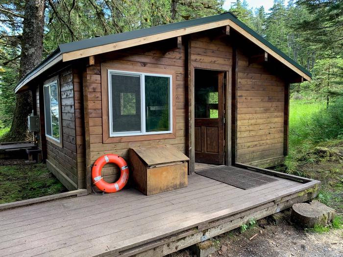
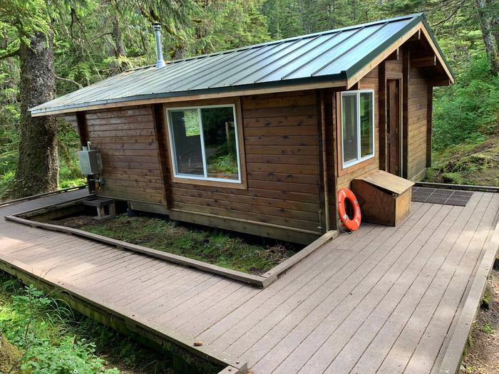
The 16 x 20 foot cabin sleeps six and is equipped with wooden bunks, a table with benches, an oil drip (kerosene) stove for heat and an outhouse with pit toilet. Cabin users must supply thier own fuel for stove. Typically 1 gallon of kerosene/ day is sufficent.
The cabin meets accessibility standards, with a boardwalk leading to the outhouse, more floor space and wider doors to accommodate wheelchairs. There is however a short but steep approach from the salt water to the boardwalk that will require assistance.
Water and electricity are not provided. Drinking water is accessible by kayak at Lagoon Creek or by walking south of the cabin along the shoreline at low tide, although water taken from natural sources should be treated before drinking.
Items such as a cook stove, cooking gear, flashlights or lanterns, bedding, toilet paper, kerosene and garbage bags are not provided. Guests are expected to pack out their trash and clean the cabin before leaving.
Natural Features
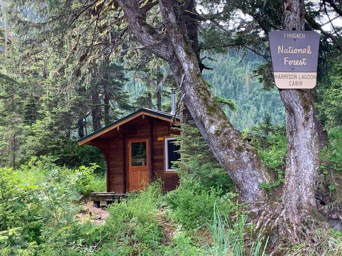
Harrison Lagoon is located on the west side of Port Wells in Prince William Sound. The cabin is tucked into a stand of conifer trees on a gravel spit that separates the lagoon and the Sound. One side faces Port Wells, and the other faces the lagoon. The lagoon itself is surrounded by rocky shoreline and dense evergreen forest, with views of distant snow-capped mountains.
Black bears, Sitka black-tailed deer and bald eagles make their home here (learn about bear safety). The lagoon and Port Wells support many seabirds. Dall’s and harbor porpoises, harbor seals, sea otter and some sea lions frequent the area. Orcas and humpback whales may be seen in Port Wells.