
Directions
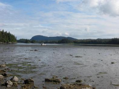
Access is by boat (66 miles from Petersburg or 26 miles from Kake) or float plane (44 miles from Petersburg). A 16-foot tide is required for direct float plane access to the cabin. Arrival at lower tides will require a half-mile walk on the tide flat. Refer to USGS topographic map Petersburg C6. Petersburg D6 may also be helpful. Maps are available online or by calling the Petersburg Ranger District at (907) 772-3871.
Phone
907-772-3871
Activities
BOATING, CAMPING, FISHING, HUNTING, WILDLIFE VIEWING
Keywords
DEVW,DEVIL’S ELBOW,DEVILS ELBOW,DEVIL’S,DEVIL,DEVIL S ELBOW CABIN,TONGASS NF – FS
Related Link(s)
Overview
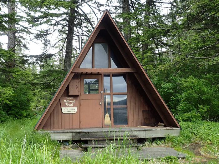
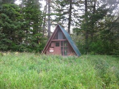
Devil’s Elbow Cabin is set back from the coastal water in a scenic area of southeastern Alaska. It provides access to a variety of recreational activities, including fishing, hunting and viewing wildlife. The location is also popular among rockhounds and geology enthusiasts.
The cabin is accessible by boat or float plane only, and tides impact access. Those arriving by boat should be prepared to hike a half-mile to reach the cabin if they arrive at low tide. Visitors are responsible for their own travel arrangements and safety, and must bring several of their own amenities.
Recreation
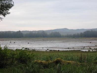
The cabin’s location makes it a favorite among kayakers and canoers, as it provides some protection from inclement weather. Rocky Pass is known for its interesting geology, inviting boaters from all over. Low tides affect boat navigation over the tide flats around the cabin, so boaters should consult tide charts in advance (local tide tables). Hunting is possible for waterfowl, grouse and bear in designated seasons as per state or federal hunting regulations; click here for more information from the Alaska Department of Fish and Game. Anglers may find steelhead during April and May and coho salmon in August and September. The tide flats are a rockhound’s paradise.
Facilities
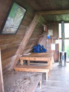
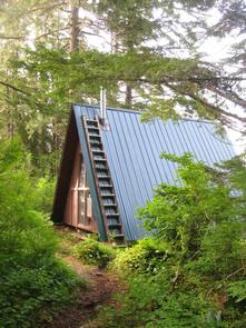
The A-frame cabin has bunks and a sleeping loft to accommodate up to seven people. It is equipped with a table, benches and an oil stove for heat. An outhouse with a pit toilet is provided. Water for drinking, cooking and cleaning is not provided at the cabin. Water taken from the creek, which is a quarter-mile south of the cabin, should be treated or boiled before consumption. Visitors are encouraged to bring their own drinking water if possible. Heating oil is not supplied at the cabin. Visitors must bring enough kerosene or No. 1 heating oil for the oil heater, approximately one gallon per day. Visitors need to bring their own sleeping bags and pads, cook stove and cooking gear, towels, food, clothing, fire starter and garbage bags, among other necessities. All trash and food must be packed out, and visitors are expected to clean the cabin before leaving. Click here for more cabin details and maps.
Natural Features
The cabin is located on a narrow isthmus on Kuiu Island in Rocky Pass. It is along Keku Strait between Kuiu and Kupreanof Island. The cabin sits near the Devil’s Elbow, a sharp turn in Rocky Pass for which the cabin is named. The cabin is surrounded by tide flats for several miles to the south. It is also situated along a major waterfowl resting area, making the spot a favorite of hunters. A variety of wildlife also makes its home in the area, including grouse, seals, black bears and wolves (learn about bear safety ).