

Directions
Accessible generally mid-April through October. Located 35 air miles northeast of Sitka, on the southeast side of Chichagof Island, about 30 minutes by floatplane.
Access is also possible by boat to Peril Strait, then hiking about 3 miles on logging road system. This mode of access is recommended only for those who know the area well.
For geographic features surrounding the cabin, refer to USGS topographic maps Sitka C-4, B-4, and C-3.
Phone
907-747-6671
Activities
BOATING, CAMPING, FISHING, HIKING, HUNTING
Keywords
WSIT,WEST STIKOH LAKE CABIN,SITKOH LAKE WEST CABIN,TONGASS NF – FS
Related Link(s)
Overview
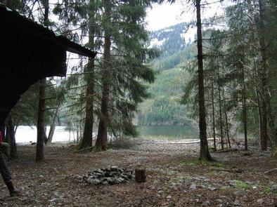
Sitkoh Lake West Cabin is nestled at the northwest shore of Sitkoh Lake on southeastern Chichagof Island, 35 miles northeast of Sitka, Alaska. Sitkoh Lake offers two public recreation cabins. The other cabin, Sitkoh Lake East Cabin, is near the east end of the lake. This is a remote site. The cabin can be accessed when the lake is ice-free, generally April through October, via a 30-minute flight from Sitka. The cabin can also be reached by boat to False Island in Peril Strait, followed by an 10 mile hike, bike or OHV ride on the False Island road system. From False Island, follow Roads 7540, 7544 and 75442 as shown on the Sitka Motor Vehicle Use Map. Visitors are responsible for their own travel arrangements and safety, and must bring their own amenities.
Recreation
Sitkoh Lake West Cabin offers fishing, hiking, hunting, off-highway vehicle riding, and berry picking opportunities. The lake supports cutthroat trout and Dolly Varden. The outlet stream at the east end of the lake, Sitkoh Creek, has runs of steelhead in the spring, pink and sockeye salmon from July to August and coho salmon from August to September.
Although it is in poor condition, hikers can explore a 4.3-mile trail along Sitkoh Creek to Sitkoh Bay. The trail begins at the Sitkoh Lake East Cabin. Past logging has left a system of isolated roads, one of which passes within 1/4-mile of the cabin.
Deer hunting is a popular activity in the surrounding area. Waterfowl hunting is allowed on Sitkoh Bay. Past logging has left a system of isolated roads, one of which passes within 1/4-mile of the cabin and is available for hiking and off-highway vehicle riding.
Facilities
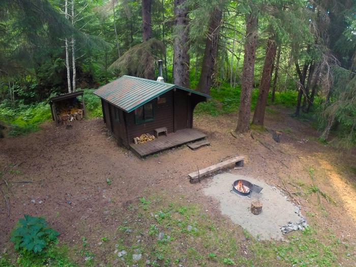
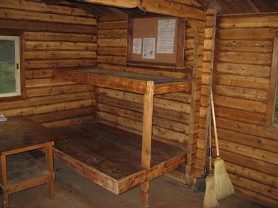
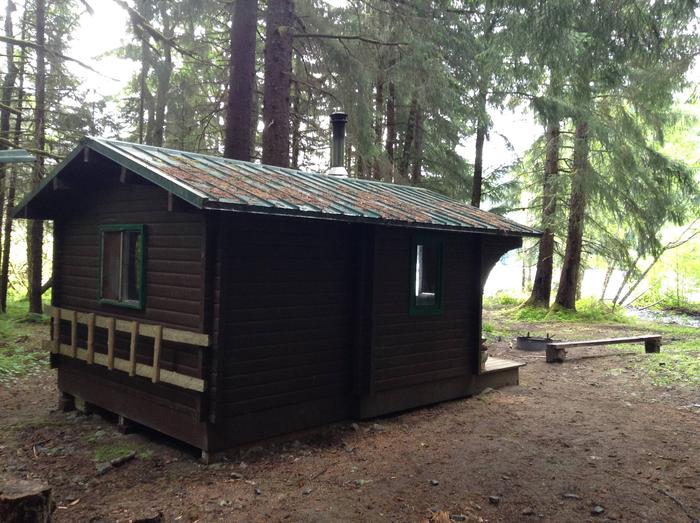
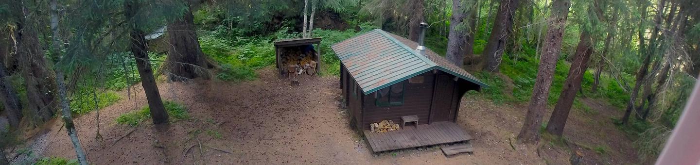
The 12 by 14-ft wood Pan abode-style cabin can accommodate up to six people with two double bunks and two single bunks. Amenities include a wood stove for heat, a table with benches, cooking counter, cupboard, broom, axe or splitting maul and an outdoor screened cooler box. An outhouse toilet is located close to the cabin.
The cabin does not include mattresses or cooking utensils. Visitors should bring sleeping bags and pads, a cooking stove, pots, pans, plates, utensils, food, toilet paper, a lantern, garbage bags, a fire extinguisher, fire starter, rain gear, boots and personal flotation devices (PDFs).
Water is available from a nearby creek but must be treated before using. It’s recommended that visitors bring their own water.
A small but heavy square-bowed skiff (rowboat) is provided. A long-shaft 2-10 horsepower outboard motor enhances use of the skiff but is not provided. Each person in the skiff should wear a Coast Guard approved PFD. Be sure plug is in before launching boat. Tie skiff well up on shore and pull plug before leaving so boat does not fill with rain water.
Click here for more cabin information and maps.
Natural Features
The cabin lies near the edge of the lake and is surrounded by towering old-growth spruce and hemlock, with muskeg and open meadows to the east. Seasonal salmonberries and blueberries are abundant. The lake’s inlet creek is nearby.
Sitkoh Lake is surrounded by forested mountains rising to near 2,500 feet. The lake sits at an elevation of 194 feet and is 2.5 miles long and a half-mile wide. Brown bear frequent the area.
Nearby Attractions
An abandoned logging camp lies about 6 miles east of the cabin at False Island, with a road system available for exploring surrounding area.