


Directions
Accessible year round, weather permitting. Located 12 air miles south of Sitka on Baranof Island within Kanga Bay. From Sitka, floatplane access is 10 minutes, boat access is 40 minutes. For geographic features surrounding the cabin, refer to USGS topographicmaps Port Alexander D-5 and D-4.
Please consult local tide tables before departing for the cabin.
Phone
907-747-6671
Activities
BOATING, CAMPING, FISHING, HUNTING
Keywords
KANG,TONGASS NF – FS
Related Link(s)
Overview
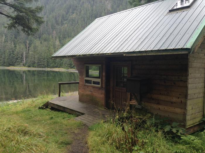
Kanga Bay Cabin overlooks a secluded cove off Redoubt Bay on Baranof Island, and was built in 1998 by local volunteers. It’s available year round, weather permitting, and makes an excellent base for experiencing and exploring this corner of Alaska.
The site is remote. It can only be accessed by floatplane or boat. It’s 10-minute plane ride or a 40-minute boat ride from Sitka. Visitors are responsible for their own travel arrangements and safety, and must bring several of their own amenities.
Recreation
Visitors enjoy fishing for sockeye and coho salmon during August at Redoubt Lake, about 30 minutes away by boat. The bay offers a great location for kayaking, but visitors must provide their own kayaks.
For information about fishing and hunting permits and seasons, visit the Alaska Department of Fish and Game website.
Facilities
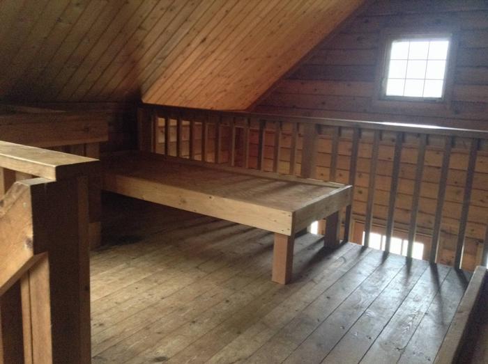
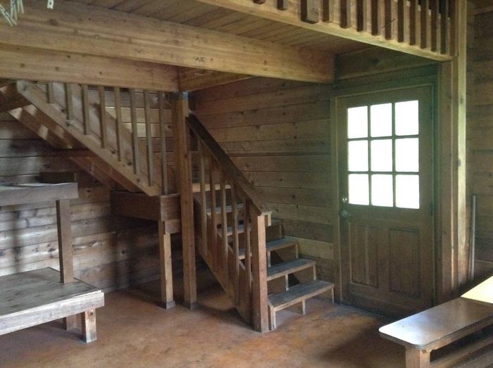
The wooden, Pan abode-style cabin measures 15 by 17 feet and can accommodate up to six people. A large deck extends across the front of the cabin. One double plywood bunk and one single plywood bunk are furnished on the main level. A staircase accesses the open sleeping loft, which has two single plywood bunks and overlooks the main level. Amenities include a wood stove for heat, a table with benches, a cooking counter, broom and an axe or splitting maul. An outhouse toilet is close to the cabin. A mooring buoy is available on a first-come, first-served basis for boat anchorage. Cabin reservation does not include exclusive use of the buoy. Mooring buoys are configured using a 4200-lb concrete block with 90 feet of 7/8th-inch stud link chain. Mariners are responsible for determining how suitable an anchoring system is for the size of their craft. The cabin does not include mattresses or cooking gear. Visitors should bring sleeping bags and pads, a cooking stove, pots, pans, plates, utensils, food, toilet paper, a lantern, garbage bags, a fire extinguisher, fire starter, raingear and rubber boots. Water available from nearby stream, 100 feet from the cabin, but must be treated before using. It’s recommended that visitors bring their own water. Click here for more cabin information and maps.
Natural Features
The cabin faces southeast, overlooking a cove, with distant views possible of the snow-capped peaks over Redoubt Bay. A spruce and hemlock forest surrounds the cabin, which sits just above a sloping, sand pebble beach. Deer, brown bear and a variety of seabirds inhabit the area.
Nearby Attractions
Popular Goddard Hot Springs is about a 20-minute boat ride to the south, where soaking pools are open to the public on a first-come, first-served basis.