


Directions
Accessible year round, weather permitting. Located 65 miles northwest of Sitka on Chichagof Island within the West Chichagof-Yakobi Wilderness Area. Boat access is possible with anchorage in Mirror Harbor, where 0.9-mile White Sulphur Springs Trail leads to the cabin; however, local knowledge is recommended before attempting anchorage there.
White Sulphur Springs Trail begins at Mirror Harbor and leads to the cabin. The trail is fairly level and parallels Bertha Bay.
Please consult local tide tables before departing for the cabin. For geographic features surrounding the cabin, refer to USGS topographic maps Sitka D-8 and D-7.
Phone
907-747-6671
Activities
BOATING, CAMPING, FISHING, HIKING
Keywords
WHUR,TONGASS NF – FS
Related Link(s)
Overview
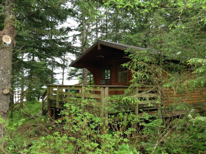
White Sulphur Springs Cabin is located on the northern shore of Bertha Bay, 65 miles northwest of Sitka, Alaska, on Chichagof Island within the West Chichagof-Yakobi Wilderness Area. The cabin makes an excellent base for experiencing and exploring this corner of Alaska.
This is a remote site in a designated Wilderness area. The cabin can be accessed by boat only, weather permitting. Visitors are responsible for their own travel arrangements and safety, and must bring their own amenities.
Recreation
Recreation options include fishing, boating, hiking, photography and soaking in a natural warm springs pool. With easy terrain, many areas around the cabin are accessible to hikers. Lake Elfendahl and Lake Morris are only a 2-hour hike away. The Dry Pass Trail to Sea Level Slough can be difficult to follow and requires lower tide to cross the slough. The White Sulphur Springs Trail to Mirror Harbor is marked and easy to follow.
The warm springs is about 50 feet from the cabin with no fee for use. However reserving this cabin does not include exclusive use of the warm springs. Cabin users must be prepared for warm springs visitors at any time.
For information about fishing permits and seasons, visit the Alaska Department of Fish and Game website.
Facilities
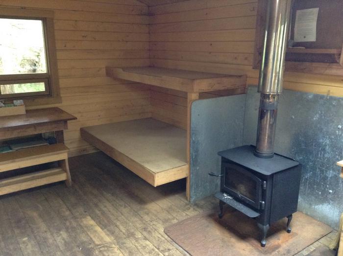
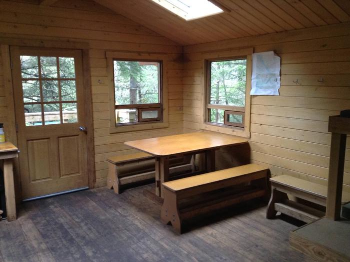
The 12’x14′ Pan Abode-style cabin accommodates six people, with two double plywood bunks and two single plywood bunks. Amenities include a wood stove for heat, a table with benches, cooking counter, broom, an axe or splitting maul and an outhouse toilet.
The cabin does not include mattresses or cooking utensils. Visitors should bring sleeping bags and pads, a cooking stove, pots, pans, plates, utensils, food, toilet paper, garbage bags, a lantern, fire extinguisher and fire starter. Rain gear and boots are recommended.
No good water source is available near the cabin.
Click here for more cabin information and maps.
Natural Features
A forest of spruce and hemlock surrounds the cabin, which overlooks beautiful views of the North Pacific with breakers crashing on nearby rocky cliffs. White Sulphur Springs offers a natural warm springs frequented by many forest visitors. Brown bear frequent the area.