

Directions
Access to the cabin is by floatplane. It is about a 30-minute flight from Juneau. In fall, winter and early spring, the cabin may be inaccessible due to frozen lake surface (floatplanes cannot land). The lake is normally ice free from mid-May through November. Refer to USGS topographic map Sitka D-2, D-3. Click here for information about reaching Forest Service Cabins.
Phone
907-586-8800
Activities
BOATING, CAMPING, FISHING, WILDLIFE VIEWING
Keywords
KATH,TONGASS NF – FS
Related Link(s)
Overview
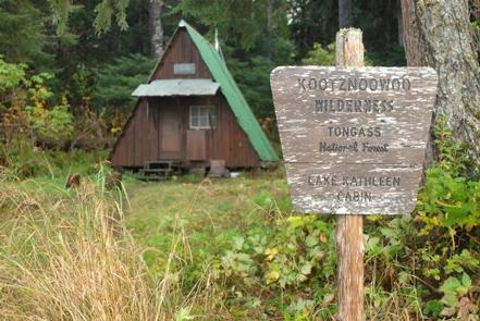
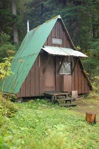
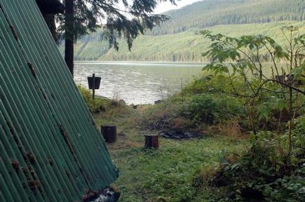
Kathleen Lake Cabin offers recreation, relaxation and a unique wilderness lodging experience on the western section of Admiralty Island in the Tongass National Forest. The remote site offers a scenic setting for fishing, boating and wildlife viewing.
Access to the cabin is floatplane only. Visitors are responsible for their own travel arrangements and safety, and must bring several of their own amenities.
Recreation
Anglers will find Kathleen Lake to be a scenic setting for catching a variety of fish including rainbow trout, Dolly Varden and northern pike.
Visitors are welcome to use the skiff with oars available at the cabin, and may choose to bring a small outboard motor. The motor must be less than 10 horsepower due to wilderness regulations, and visitors must bring personal floatation devices (life vests).
Facilities
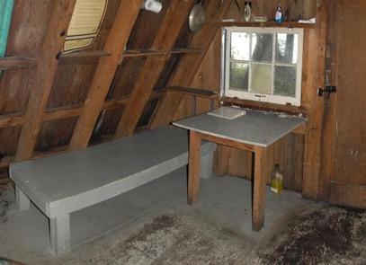
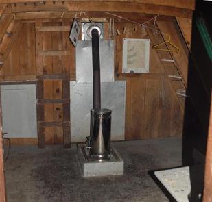
The primitive, pre-cut cedar, A-frame style log cabin sleeps up to six people on wooden bunkbeds without mattresses and sleeping loft. The cabin is equipped with a table, benches, an oil stove for heat and an outside toilet. Other amenities include cooking counters, shelves, cupboard space and a broom.
The cabin does not have running water or electricity, and visitors must bring their own food, water, #1 stove oil (, sleeping bags, sleeping pads, cook stoves, matches, cooking gear/utensils, light source, toilet paper, first aid kit and garbage bags.
The lands surrounding the Forest Service property and cabin belong to the Shee Atika Corporation. A permit is required for any activity on corporation land. Entry without a permit will be considered trespassing and subject to legal action. The cost of the permit for noncommercial users is $25/person for up to 7 consecutive days. This fee-based permit was instituted by Shee Atika during the summer of 2004. To obtain a permit, call the Shee Atika office at (907) 747-3534 or toll free at 1-800-478-3534. (The forested land immediately surrounding the cabin is Forest Service land and does not require a permit.
Click here for more cabin details.
Natural Features
The cabin sits on level ground within steps of a small beach. Although this cabin sits beneath a canopy of old-growth trees, much of the surrounding area is private land, and has been clearcut. The area around the cabin shows a patchwork pattern of logged and unlogged areas.
Dense spruce and hemlock forests, glacier-fed streams and muskeg define the surrounding landscape, while rocky, glacier-capped peaks rise in the distance.
Wildlife in the area abounds. Sitka black-tailed deer stay well hidden in the dense forest, bald eagles are found in treetops along most beaches and migratory waterfowl find habitat on numerous lakes. Brown bears are in abundance.