

Directions
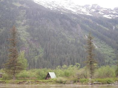
Located on the north side of the Stikine River near Figure 8 Lake (Twin Lakes), in the Stikine-LeConte Wilderness. The cabin is 17 miles from Wrangell, accessible by shallow draft boat or float plane during moderate to high river levels. A minimum 16-foot river level is generally needed for float plane landings. Low river levels limit small boat access as Hooligan Slough becomes shallow or blocked. A tide of 14 feet or higher is required for a shallow draft boat to cross the tide flats. The river is normally ice-free May to October. Please check local conditions ahead of time by calling the Wrangell Ranger District at (907) 874-2323.
Phone
907-874-2323
Activities
BOATING, CAMPING, FISHING, HUNTING, WATER SPORTS, WILDLIFE VIEWING, SWIMMING SITE
Keywords
TWES,TONGASS NF – FS
Related Link(s)
Overview
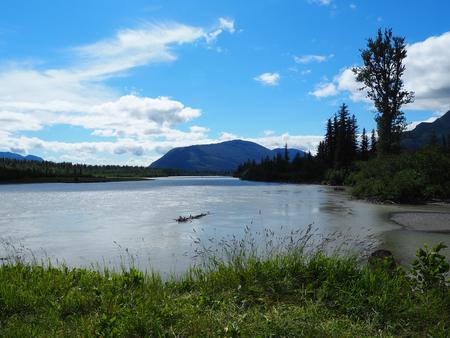
Twin Lakes Cabin is located on the Stikine River in the Stikine-LeConte Wilderness. It provides access to Twin Lakes, a popular area for swimming and boating. The location also provides access to fishing, hunting and wildlife viewing opportunities. The site can be accessed by shallow draft boat, float plane or kayak, depending on conditions. Low river levels can affect access to the cabin and Twin Lakes. Guests are responsible for their own travel arrangements and safety, and must bring several of their own amenities.
Recreation
Fishing is possible in Dog Salmon Creek (North Arm Creek) about 1.7 miles west of the cabin. Cutthroat trout is available from May through September. Salmon fishing includes chum, pink in July and August, and silver in August and September. Twin Lakes offers opportunities for swimming, paddling and water skiing. A picnic site is located on the south shore of the lake that includes two campfire rings and an outhouse. When entrance to the lakes becomes restricted at low river levels, a 0.1-mile trail leads from the cabin to the site ( Stikine River level at Shakes Gage ). It is possible to explore the Stikine River area and the Stikine-LeConte Wilderness by canoe or kayak, but local tide charts and river levels should be consulted in advance. Hunting is available in the area with the proper permits.
Facilities
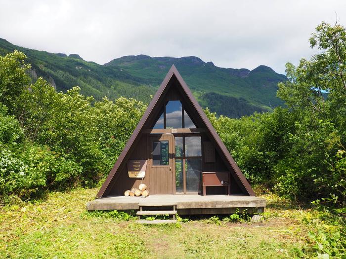
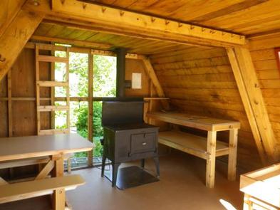
The 16-by-16 cabin (A-frame style) was built in 1962 and has two single bunks (one with a trundle bed) and a second-floor loft, to sleep up to seven people. The cabin also has a table with benches, oil stove (No.1 oil only), broom and outhouse. The partially covered front porch has a built-in bench and wooden cooler box for food storage. Water and electricity are not provided. Water is available from the lake or slough, but guests should be sure to treat water before taken from any outdoor source prior to drinking or cooking with it ( water safety tips ). It is recommended that guests bring their own water supply. Heating oil is not supplied by the Forest Service. In addition to bringing a supply of No.1 stove oil, guests should pack sleeping bags, sleeping pads, a cooking stove, lanterns or flashlights, cookware, plates, utensils, food, toilet paper, garbage bags, a fire extinguisher and matches, among other necessities. Guests are expected to pack out trash and clean the cabin before leaving ( click here for more cabin details).
Natural Features
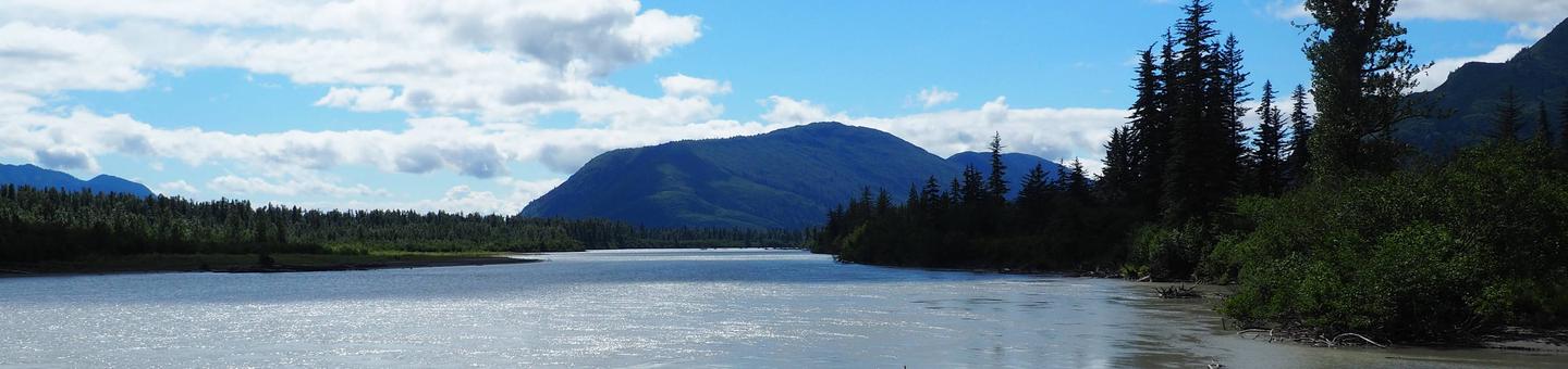
The cabin sits on relatively flat land on the mouth of Twin Lakes Slough, facing Limb Island and the upper end of Hooligan Slough. The surrounding trees are primarily Sitka spruce, cottonwood, alder and willow. The vegetation in front of the cabin is mostly grass, with meadows nearby. A sand beach between the riverbank and the slough can be accessed at low river levels. Steep mountains rise from behind Figure 8 Lake, known locally as Twin Lakes, which is about 400 feet behind the cabin. Brown and black bears are common in the area, and moose may be seen in the willow thickets ( bear safety information ). Mountain goats inhabit the nearby mountains. The Stikine River tide flats are a major stop for migratory waterfowl and shorebirds in the spring and fall.