ITALIO RIVER CABIN, AK Campground Reservation, Info, Images, Map, Directions

ITALIO RIVER CABIN, Alaska Campground Images, Info & Reservations

Listen

Directions

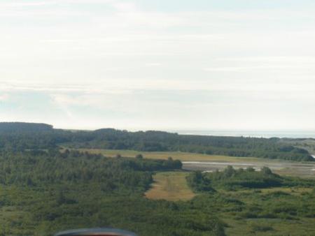
Located 30 miles SE of Yakutat, the cabin is on the west bank of Hooligan Creek, a half-mile from the Old Italio River. Access is by wheeled plane on a tidal flat airstrip. The 1,600×100-ft. airstrip may flood at extreme high tides or after heavy rains. Please consult tide charts in advance, since tides can affect access to this cabin.

Phone

(907) 784-3359

Activities

CAMPING, FISHING, HUNTING, WILDLIFE VIEWING

Keywords

ITAL,TONGASS NF – FS

Related Link(s)

Rec Area Info & Images

Alaska State Road Conditions

Alaska State Tourism

Overview

Italio River Cabin is situated on the west bank of Hooligan Creek about half a mile from the Old Italio River and the Gulf of Alaska. This remote retreat is open year-round and makes an ideal base for fishing or hunting trips. The site can be accessed by wheeled plane, depending on conditions. The nearby airstrip is on tidal flats, making it prone to flooding and debris. Visitors are responsible for their own travel arrangements and safety, and must bring several of their own amenities.

Recreation

The Old Italio, New Italio and Akwe River systems offer outstanding fishing for rainbow trout, Dolly Varden and steelhead, as well as sockeye, pink, king and coho salmon. Moose hunting is good to excellent.

Facilities

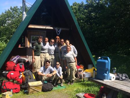
This 14×20-ft. A-frame style cabin sleeps six people and comes with two single bunks and a sleeping loft. Other amenities include a table with benches, broom and an oil heater. A picnic table and campfire ring are located outside. An outhouse with pit toilet and a 12×12-ft. meat shed are located on-site. Water, electricity and heating oil are not provided. Visitors must bring their own supply of drinking water, as well as #1 stove oil for the heater. One gallon lasts 2-10 hours, depending on the heat setting. Other items to bring include sleeping bags, sleeping pads, food, a cooking stove, cookware, plates, utensils, lanterns, flashlights, toilet paper, garbage bags, a fire extinguisher and fire starter. Visitors are expected to pack out trash and clean the cabin before leaving. Click here for more cabin details.

Natural Features

The cabin sits on relatively flat terrain that can get very wet. The surrounding vegetation is predominantly brush with scattered willow and alder thickets and cottonwoods. The nearby tidal flats often flood during high tide or heavy rains ( local tide charts ). Large populations of moose and brown bears live in this area. Bald eagles and ravens are common, and gulls are often seen along the river.

Reservation

More from CampingHiking.net:

THOMSON CAUSEWAY, Illinois Campground Images, Info & Reservations

Listen Directions Take IL Route 84 to Thomson, Illinois. Turn west onto Main Street, then turn south onto Lewis Avenue. Phone 815-259-3628 Activities BIKING, CAMPING, FISHING, HIKING, HUNTING, DAY USE AREA Keywords THOS,MISSISSIPPI RV. RI,thompson Related Link(s) Rec Area Info & Images Illinois State Road Conditions Illinois State Tourism Overview

ROCK CREEK GROUP, Utah Campground Images, Info & Reservations

Listen Directions From Duchesne, Utah, take Highway 87 north 15 miles to the Mountain Home turnoff and turn left. Continue 2.5 miles north to the Rock Creek Store and turn left toward Rock Creek Canyon. Proceed approximately 14 miles to the campground. Phone 435-738-2482 Activities BIKING, CAMPING, FISHING, HIKING, WILDLIFE

BEAR CANYON, Utah Campground Images, Info & Reservations

Listen Directions From I-15, take Nephi exit 225. Travel about 5 miles east on Highway 132 to the Nebo Loop Scenic Byway. Turn left onto the byway and travel 3.5 miles to the Bear Canyon turnoff. Turn left. Bear Canyon Campground is located at the end of the road, just

KENTS LAKE CAMPGROUND, Utah Campground Images, Info & Reservations

Listen Directions Travel east of Beaver approximately 10 miles on SR 153, then turn right on to Forest Road 137 for about 5 miles. Phone 435-438-2436 Activities CAMPING, FISHING, WILDLIFE VIEWING Keywords Middle Kents Lake,Kents Lake,Kent’s Lake Related Link(s) Rec Area Info & Images Utah State Road Conditions Utah State

HOYER, Arizona Campground Images, Info & Reservations

Listen Directions From Show Low, Arizona, take Highway 260 southeast 42 miles to Highway 373. Take Highway 373 south 3 miles to the campground, which is on the right. Phone 928-735-7313 Activities CAMPING, PICNICKING, DAY USE AREA Keywords HOYE,APACHE-SITGREAVES NF-FS Related Link(s) Rec Area Info & Images Forest Service Concessionaire

PACKSADDLE, California Campground Images, Info & Reservations

Listen Directions From Sierra City, travel east on Highway 49 for 5 miles. Turn left at Bassett Station on Gold Lake Highway and continue just over a mile to Packer Lake Road and turn left. Go less than a mile and turn right on Packer Lake Road. Continue for about